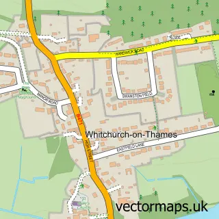
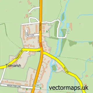
This Whitchurch Hill street map is a detailed vector street map covering a 750m x 750m area. Select a larger area to create and download your own vector street map of Whitchurch Hill.
The 750-metre map sample for Whitchurch Hill covers 262 mapped buildings and approximately 8.6 km of road detail, of which 9 named roads are named. The immediate area includes 2 GP surgeries within 2 miles, 1 pub and 3 MOT stations within 2 miles. The wider area around Whitchurch Hill features 1 food and drink venue. To create a larger or custom map of Whitchurch Hill, the map builder lets you define your own coverage area and download editable SVG, PDF and PNG files.
Create a larger editable map of Whitchurch Hill
Choose any area you need and generate a high-quality vector map instantly. Perfect for print, planning, design, business and personal use.

This Whitchurch Hill street map in Oxfordshire is available as downloadable SVG, PDF and PNG map files, or as a printed map for planning, business, display, education, local information and design work. You can also create a larger custom map area using the map selector.
What this Whitchurch Hill map sample shows
Whitchurch Hill lies within Goring Heath Cp parish, part of Kidmore End & Whitchurch ward in the South Oxfordshire District local authority area. The postcode geography for this area includes the RG postcode area, the RG8 postcode district and the RG8 7 postcode sector. Residents fall under the Nhs Buckinghamshire, Oxfordshire And Berkshire West Integrated Care Board for NHS services.
Local features near Whitchurch Hill
Within 2 milesAmenities and services in and around Whitchurch Hill.
Administrative and postcode information for Whitchurch Hill
The local authority covering Whitchurch Hill is South Oxfordshire District, within the county of Oxfordshire. The settlement lies within Kidmore End & Whitchurch ward and Goring Heath Cp civil parish. The RG8 postcode district and RG8 7 postcode sector serve the immediate area. NHS provision in the area is delivered through Royal Berkshire Nhs Foundation Trust.
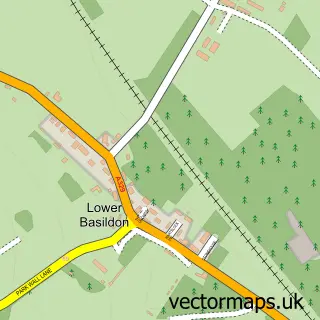
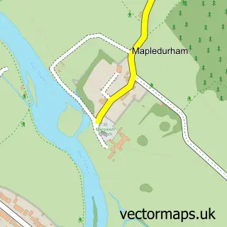
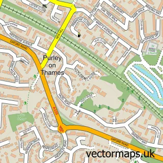
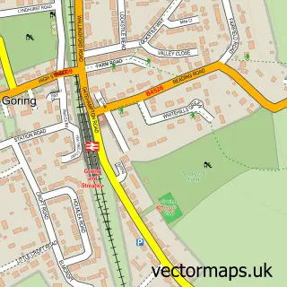
Nearby street map samples around Whitchurch Hill

More street maps in Oxfordshire
750 metre map area coverage
Boundary, postcode and point of interest information for the 750m x 750m rectangle centred on this sample map.
Boundaries containing map centre
Constituency: Henley and Thame Co Const
County: Oxfordshire County
District: South Oxfordshire District
Icb: NHS Thames Valley ICB
Parish: Goring Heath CP
Police Force: thames valley
Postcode District: RG8
Postcode Sector: RG8 7
Ward: Kidmore End & Whitchurch Ward
Nearby boundaries intersecting sample
No additional intersecting boundaries found.
Postcode coverage
POI category counts
Anglican Church: 1
Building Supply Store: 1
Business Consulting: 1
Business Management Services: 1
Elementary School: 1
Fitness Trainer: 1
Flooring Contractors: 1
Flowers And Gifts Shop: 1
Importer And Exporter: 1
Osteopathic Physician: 1
Sample points of interest
- Whitchurch Hill St. John the Baptist
- Park Home Chassis Services
- Actioncoach
- ActionCOACH Business Coaching
- Whitchurch County Primary School
- Blissful Bambino
- Liberty Flooring
- The Flower Artisan
- Probe International
- Birdsong Osteopathy
- Bathstone
- The Sun
Create a larger editable map of Whitchurch Hill
This sample shows only a 750 metre area. To create a larger map of Whitchurch Hill, use our map builder to choose your own coverage area, add titles and download editable SVG, PDF and PNG files.
Create a custom map of Whitchurch Hill