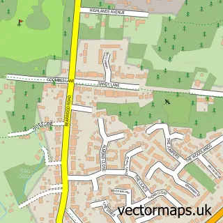
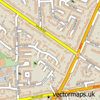
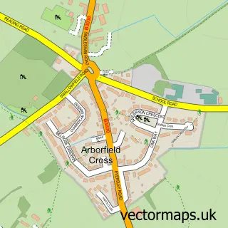
This Wokingham street map is a detailed vector street map covering a 750m x 750m area. Select a larger area to create and download your own vector street map of Wokingham.
The 750-metre map sample for Wokingham covers 420 mapped buildings and approximately 18.3 km of road detail, of which 46 named roads are named. The immediate area includes 2 schools, 1 GP surgery, with 2 within 2 miles, 17 pubs and 12 MOT stations within 2 miles. The wider area around Wokingham features 5 tourism points of interest, 44 food and drink venues and 2 hotels. To create a larger or custom map of Wokingham, the map builder lets you define your own coverage area and download editable SVG, PDF and PNG files.
Create a larger editable map of Wokingham
Choose any area you need and generate a high-quality vector map instantly. Perfect for print, planning, design, business and personal use.

This Wokingham street map in Berkshire is available as downloadable SVG, PDF and PNG map files, or as a printed map for planning, business, display, education, local information and design work. You can also create a larger custom map area using the map selector.
What this Wokingham map sample shows
Wokingham lies within Wokingham Cp parish, part of Emmbrook ward in the Wokingham (B) local authority area. The postcode geography for this area includes the RG postcode area, the RG41 postcode district and the RG41 2 postcode sector. Residents fall under the Nhs Buckinghamshire, Oxfordshire And Berkshire West Integrated Care Board for NHS services.
Local features near Wokingham
Within 2 milesAmenities and services in and around Wokingham.
Administrative and postcode information for Wokingham
The local authority covering Wokingham is Wokingham (B), within the county of Berkshire. The settlement lies within Emmbrook ward and Wokingham Cp civil parish. The RG41 postcode district and RG41 2 postcode sector serve the immediate area. NHS provision in the area is delivered through Royal Berkshire Nhs Foundation Trust.
Nearby street map samples around Wokingham

More street maps in Berkshire
750 metre map area coverage
Boundary, postcode and point of interest information for the 750m x 750m rectangle centred on this sample map.
Boundaries containing map centre
Constituency: Wokingham Co Const
District: Wokingham (B)
Icb: NHS Thames Valley ICB
Parish: Wokingham CP
Police Force: thames valley
Postcode District: RG40
Postcode Sector: RG40 1
Ward: Norreys Ward
Nearby boundaries intersecting sample
Postcode Sector: RG40 2
Ward: Emmbrook Ward, Wescott Ward
Postcode coverage
POI category counts
Real Estate Agent: 23
Pub: 17
Charity Organization: 13
Indian Restaurant: 13
Professional Services: 13
Coffee Shop: 11
Employment Agencies: 11
Beauty Salon: 10
Barber: 9
Dentist: 9
Sample points of interest
- Bettridge & Co Chartered Accountants
- Claritas Accountancy
- John Ellis
- Melanie Curtis Accountants
- Millward, May & Co
- PPK Chartered Accountants
- Ppk Accountants Ltd.
- TaxAssist Accountants
- Acupuncture Wokingham
- Jonathan Pledger Bsc (Hons), MRes, LicAc. MBAcC
- Axlr8
- Daws And Associates Ltd.
Create a larger editable map of Wokingham
This sample shows only a 750 metre area. To create a larger map of Wokingham, use our map builder to choose your own coverage area, add titles and download editable SVG, PDF and PNG files.
Create a custom map of Wokingham