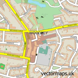
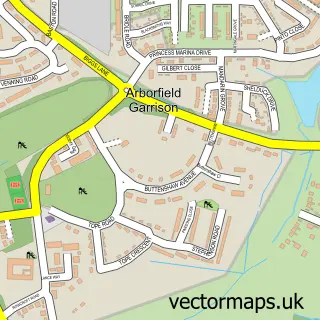
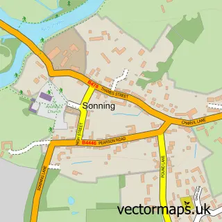
This Sindlesham street map is a detailed vector street map covering a 750m x 750m area. Select a larger area to create and download your own vector street map of Sindlesham.
The 750-metre map sample for Sindlesham covers 205 mapped buildings and approximately 19.3 km of road detail, of which 22 named roads are named. The immediate area includes 1 school, 1 GP surgery within 2 miles, 1 pub and 11 MOT stations within 2 miles. The wider area around Sindlesham features 1 tourism point of interest, 1 food and drink venue and 2 hotels. To create a larger or custom map of Sindlesham, the map builder lets you define your own coverage area and download editable SVG, PDF and PNG files.
Create a larger editable map of Sindlesham
Choose any area you need and generate a high-quality vector map instantly. Perfect for print, planning, design, business and personal use.

This Sindlesham street map in Berkshire is available as downloadable SVG, PDF and PNG map files, or as a printed map for planning, business, display, education, local information and design work. You can also create a larger custom map area using the map selector.
What this Sindlesham map sample shows
Sindlesham lies within Arborfield And Newland Cp parish, part of Arborfield ward in the Wokingham (B) local authority area. The postcode geography for this area includes the RG postcode area, the RG41 postcode district and the RG41 5 postcode sector. Residents fall under the Nhs Buckinghamshire, Oxfordshire And Berkshire West Integrated Care Board for NHS services.
Local features near Sindlesham
Within 2 milesAmenities and services in and around Sindlesham.
Administrative and postcode information for Sindlesham
Sindlesham lies within Arborfield And Newland Cp parish, part of Arborfield ward in the Wokingham (B) local authority area. The postcode geography for this area includes the RG postcode area, the RG41 postcode district and the RG41 5 postcode sector. Residents fall under the Nhs Buckinghamshire, Oxfordshire And Berkshire West Integrated Care Board for NHS services.
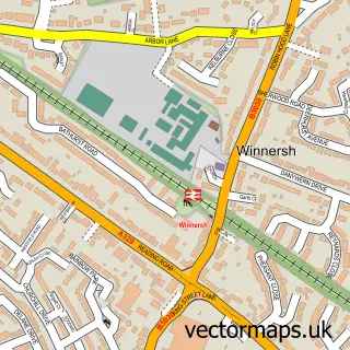
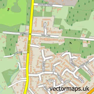
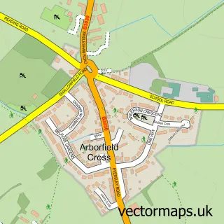
Nearby street map samples around Sindlesham

More street maps in Berkshire
750 metre map area coverage
Boundary, postcode and point of interest information for the 750m x 750m rectangle centred on this sample map.
Boundaries containing map centre
Constituency: Wokingham Co Const
District: Wokingham (B)
Icb: NHS Thames Valley ICB
Parish: Winnersh CP
Police Force: thames valley
Postcode District: RG41
Postcode Sector: RG41 5
Ward: Winnersh Ward
Nearby boundaries intersecting sample
Parish: Arborfield and Newland CP
Ward: Barkham & Arborfield Ward
Postcode coverage
POI category counts
Community Center: 2
Community Services Non Profits: 2
Dance School: 2
Hotel: 2
Printing Services: 2
Spas: 2
Advertising Agency: 1
Architectural Designer: 1
Assisted Living Facility: 1
Auditorium: 1
Sample points of interest
- Kanji
- Lee Norris Design
- Royal Masonic Benevolent Institution
- Berkshire Masonic Centre
- GTS Autos Reading
- Bearwood Recreation Ground
- Tepidarium At Nirvana Spa
- Nadia's Beauty
- Spick & Span
- Lucas Plumbing & Heating
- Provincial Grand Lodge of Berkshire
- Sindlesham Baptist Church
Create a larger editable map of Sindlesham
This sample shows only a 750 metre area. To create a larger map of Sindlesham, use our map builder to choose your own coverage area, add titles and download editable SVG, PDF and PNG files.
Create a custom map of Sindlesham