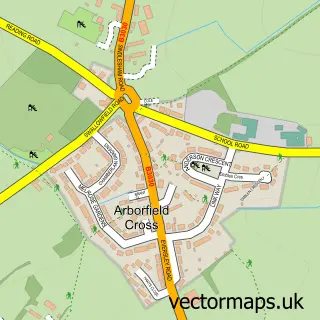
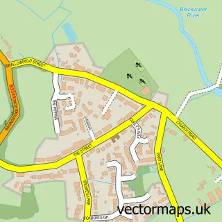
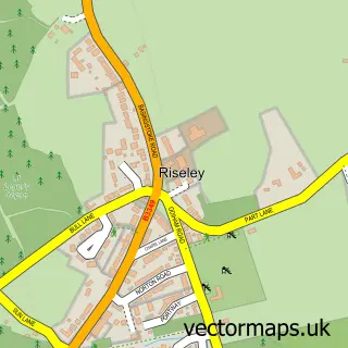
This Shinfield street map is a detailed vector street map covering a 750m x 750m area. Select a larger area to create and download your own vector street map of Shinfield.
The 750-metre map sample for Shinfield covers 624 mapped buildings and approximately 21.0 km of road detail, of which 40 named roads are named. The immediate area includes 3 GP surgeries within 2 miles and 13 MOT stations within 2 miles. To create a larger or custom map of Shinfield, the map builder lets you define your own coverage area and download editable SVG, PDF and PNG files.
Create a larger editable map of Shinfield
Choose any area you need and generate a high-quality vector map instantly. Perfect for print, planning, design, business and personal use.

This Shinfield street map in Berkshire is available as downloadable SVG, PDF and PNG map files, or as a printed map for planning, business, display, education, local information and design work. You can also create a larger custom map area using the map selector.
What this Shinfield map sample shows
Shinfield lies within Shinfield Cp parish, part of Shinfield South ward in the Wokingham (B) local authority area. The postcode geography for this area includes the RG postcode area, the RG2 postcode district and the RG2 9 postcode sector. Residents fall under the Nhs Buckinghamshire, Oxfordshire And Berkshire West Integrated Care Board for NHS services.
Local features near Shinfield
Within 2 milesAmenities and services in and around Shinfield.
Administrative and postcode information for Shinfield
Shinfield lies within Shinfield Cp parish, part of Shinfield South ward in the Wokingham (B) local authority area. The postcode geography for this area includes the RG postcode area, the RG2 postcode district and the RG2 9 postcode sector. Residents fall under the Nhs Buckinghamshire, Oxfordshire And Berkshire West Integrated Care Board for NHS services.
Nearby street map samples around Shinfield

More street maps in Berkshire
750 metre map area coverage
Boundary, postcode and point of interest information for the 750m x 750m rectangle centred on this sample map.
Boundaries containing map centre
Constituency: Earley and Woodley Boro Const
District: Wokingham (B)
Icb: NHS Thames Valley ICB
Parish: Shinfield CP
Police Force: thames valley
Postcode District: RG2
Postcode Sector: RG2 9
Ward: Shinfield Ward
Nearby boundaries intersecting sample
No additional intersecting boundaries found.
Postcode coverage
POI category counts
Beauty Salon: 3
Building Supply Store: 2
It Service And Computer Repair: 2
Painting: 2
Professional Services: 2
Real Estate Agent: 2
Accountant: 1
Anglican Church: 1
Assisted Living Facility: 1
Barber: 1
Sample points of interest
- The Back Office
- Shinfield St Mary
- Magnolia Lodge
- The Hedge Barbers - Tree & Hedge Services
- Jemma Pickett's Hair Salon
- TMK Beauty
- The Pamper Beautique
- Pretty Stitch Bridal
- KF & KP Woods Building Contractors
- Complex Property Services
- DAC Flooring
- Wessex Tree Services Ltd.
Create a larger editable map of Shinfield
This sample shows only a 750 metre area. To create a larger map of Shinfield, use our map builder to choose your own coverage area, add titles and download editable SVG, PDF and PNG files.
Create a custom map of Shinfield