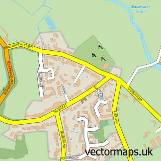
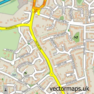
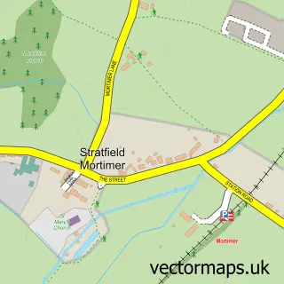
This Spencers Wood street map is a detailed vector street map covering a 750m x 750m area. Select a larger area to create and download your own vector street map of Spencers Wood.
The 750-metre map sample for Spencers Wood covers 340 mapped buildings and approximately 10.7 km of road detail, of which 22 named roads are named. The immediate area includes 2 GP surgeries within 2 miles, 1 pub and 5 MOT stations within 2 miles. The wider area around Spencers Wood features 1 food and drink venue. To create a larger or custom map of Spencers Wood, the map builder lets you define your own coverage area and download editable SVG, PDF and PNG files.
Create a larger editable map of Spencers Wood
Choose any area you need and generate a high-quality vector map instantly. Perfect for print, planning, design, business and personal use.

This Spencers Wood street map in Berkshire is available as downloadable SVG, PDF and PNG map files, or as a printed map for planning, business, display, education, local information and design work. You can also create a larger custom map area using the map selector.
What this Spencers Wood map sample shows
Spencers Wood lies within Shinfield Cp parish, part of Shinfield South ward in the Wokingham (B) local authority area. The postcode geography for this area includes the RG postcode area, the RG7 postcode district and the RG7 1 postcode sector. Residents fall under the Nhs Buckinghamshire, Oxfordshire And Berkshire West Integrated Care Board for NHS services.
Local features near Spencers Wood
Within 2 milesAmenities and services in and around Spencers Wood.
Administrative and postcode information for Spencers Wood
The local authority covering Spencers Wood is Wokingham (B), within the county of Berkshire. The settlement lies within Shinfield South ward and Shinfield Cp civil parish. The RG7 postcode district and RG7 1 postcode sector serve the immediate area. NHS provision in the area is delivered through Royal Berkshire Nhs Foundation Trust.
Nearby street map samples around Spencers Wood

More street maps in Berkshire
750 metre map area coverage
Boundary, postcode and point of interest information for the 750m x 750m rectangle centred on this sample map.
Boundaries containing map centre
Constituency: Earley and Woodley Boro Const
District: Wokingham (B)
Icb: NHS Thames Valley ICB
Parish: Shinfield CP
Police Force: thames valley
Postcode District: RG7
Postcode Sector: RG7 1
Ward: Spencers Wood & Swallowfield Ward
Nearby boundaries intersecting sample
Constituency: Wokingham Co Const
Postcode coverage
POI category counts
Pet Groomer: 3
Advertising Agency: 2
Beauty And Spa: 2
Caterer: 2
Home Cleaning: 2
Pharmacy: 2
Plumbing: 2
Accountant: 1
Active Life: 1
Architectural Designer: 1
Sample points of interest
- R & B Accountants
- Fun Flying Aircraft
- Abracadabra Leaflet Distribution
- Griffin Design
- Sarah Gould Architects
- Spring Gardens Sheltered Housing
- Jorade Commercial Services
- Warings Bakery
- Chandlers unisex hair stylists & beauty salon
- Paradise Hair & Beauty (Lynsey Ivil)
- 1-2-1 Window Cleaning
- Penrose Professional Housekeeping
Create a larger editable map of Spencers Wood
This sample shows only a 750 metre area. To create a larger map of Spencers Wood, use our map builder to choose your own coverage area, add titles and download editable SVG, PDF and PNG files.
Create a custom map of Spencers Wood