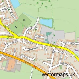
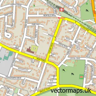
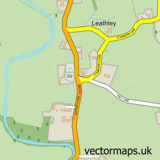
This Yeadon street map is a detailed vector street map covering a 750m x 750m area. Select a larger area to create and download your own vector street map of Yeadon.
The 750-metre map sample for Yeadon covers 541 mapped buildings and approximately 22.9 km of road detail, of which 65 named roads are named. The immediate area includes 1 school, 3 GP surgeries, with 4 within 2 miles, 10 pubs and 8 MOT stations within 2 miles. The wider area around Yeadon features 3 tourism points of interest and 19 food and drink venues. To create a larger or custom map of Yeadon, the map builder lets you define your own coverage area and download editable SVG, PDF and PNG files.
Create a larger editable map of Yeadon
Choose any area you need and generate a high-quality vector map instantly. Perfect for print, planning, design, business and personal use.

This Yeadon street map in West Yorkshire is available as downloadable SVG, PDF and PNG map files, or as a printed map for planning, business, display, education, local information and design work. You can also create a larger custom map area using the map selector.
What this Yeadon map sample shows
Yeadon lies within Rawdon Cp parish, part of Guiseley & Rawdon ward in the Leeds District (B) local authority area. The postcode geography for this area includes the LS postcode area, the LS19 postcode district and the LS19 6 postcode sector. Residents fall under the Nhs West Yorkshire Integrated Care Board for NHS services.
Local features near Yeadon
Within 2 milesAmenities and services in and around Yeadon.
Administrative and postcode information for Yeadon
Yeadon lies within Rawdon Cp parish, part of Guiseley & Rawdon ward in the Leeds District (B) local authority area. The postcode geography for this area includes the LS postcode area, the LS19 postcode district and the LS19 6 postcode sector. Residents fall under the Nhs West Yorkshire Integrated Care Board for NHS services.
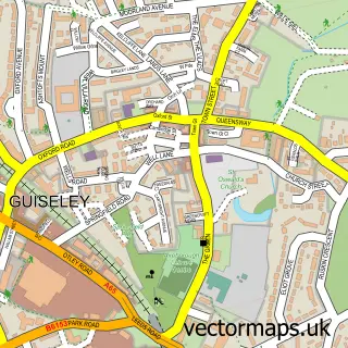
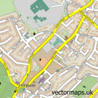
Nearby street map samples around Yeadon

More street maps in West Yorkshire
750 metre map area coverage
Boundary, postcode and point of interest information for the 750m x 750m rectangle centred on this sample map.
Boundaries containing map centre
Constituency: Leeds North West Co Const
District: Leeds District (B)
Icb: NHS West Yorkshire ICB
Police Force: west yorkshire
Postcode District: LS19
Postcode Sector: LS19 7
Ward: Otley & Yeadon Ward
Nearby boundaries intersecting sample
Ward: Guiseley & Rawdon Ward
Postcode coverage
POI category counts
Beauty Salon: 14
Hair Salon: 13
Pub: 10
Banks: 7
Doctor: 6
Automotive Repair: 5
Barber: 5
Beauty And Spa: 5
Clothing Store: 5
Building Supply Store: 4
Sample points of interest
- Henshaw Depot Yeadon
- Fox Jennings Cullen
- J S White and Co
- Defthaus
- Design Fire Consultants
- WSH Services Ltd
- Penny Wragg BA, ITEC, BRCP
- Sue Ryder Care
- Cater-Force Food Service Engineers Ltd
- Maxs Balti House And Pizza Bar
- KSC Car Audio And Equipment LTD
- Dentzilla - Paintless Dent Repairs Yorkshire
Create a larger editable map of Yeadon
This sample shows only a 750 metre area. To create a larger map of Yeadon, use our map builder to choose your own coverage area, add titles and download editable SVG, PDF and PNG files.
Create a custom map of Yeadon