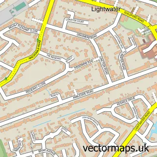
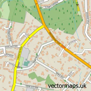
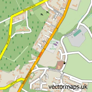
This Bagshot street map is a detailed vector street map covering a 750m x 750m area. Select a larger area to create and download your own vector street map of Bagshot.
The 750-metre map sample for Bagshot covers 445 mapped buildings and approximately 15.7 km of road detail, of which 39 named roads are named. The immediate area includes 1 school, 1 railway station, 1 GP surgery, with 2 within 2 miles and 9 pubs among other local services. The wider area around Bagshot features 1 tourism point of interest and 17 food and drink venues. To create a larger or custom map of Bagshot, the map builder lets you define your own coverage area and download editable SVG, PDF and PNG files.
Create a larger editable map of Bagshot
Choose any area you need and generate a high-quality vector map instantly. Perfect for print, planning, design, business and personal use.

This Bagshot street map in Surrey is available as downloadable SVG, PDF and PNG map files, or as a printed map for planning, business, display, education, local information and design work. You can also create a larger custom map area using the map selector.
What this Bagshot map sample shows
Bagshot lies within Windlesham Cp parish, part of Bagshot ward in the Surrey Heath District (B) local authority area. The postcode geography for this area includes the GU postcode area, the GU19 postcode district and the GU19 5 postcode sector. Residents fall under the Nhs Frimley Integrated Care Board for NHS services.
Local features near Bagshot
Within 2 milesAmenities and services in and around Bagshot.
Administrative and postcode information for Bagshot
Bagshot lies within Windlesham Cp parish, part of Bagshot ward in the Surrey Heath District (B) local authority area. The postcode geography for this area includes the GU postcode area, the GU19 postcode district and the GU19 5 postcode sector. Residents fall under the Nhs Frimley Integrated Care Board for NHS services.
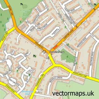
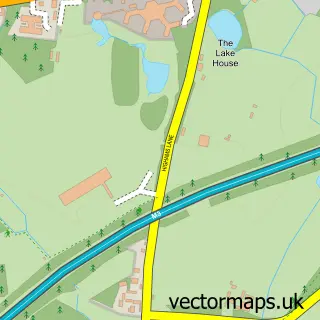
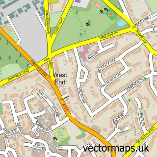
Nearby street map samples around Bagshot

More street maps in Surrey
750 metre map area coverage
Boundary, postcode and point of interest information for the 750m x 750m rectangle centred on this sample map.
Boundaries containing map centre
Constituency: Surrey Heath Co Const
County: Surrey County
District: Surrey Heath District (B)
Icb: NHS Frimley ICB
Parish: Windlesham CP
Police Force: surrey
Postcode District: GU19
Postcode Sector: GU19 5
Ward: Bagshot Ward
Nearby boundaries intersecting sample
No additional intersecting boundaries found.
Postcode coverage
POI category counts
Pub: 9
Beauty Salon: 7
Cafe: 7
Financial Service: 7
Professional Services: 6
Accountant: 5
Dentist: 5
Furniture Store: 5
Naturopathic Holistic: 5
Real Estate Agent: 5
Sample points of interest
- Accendo Accountants
- David Howard Chartered Accountants
- Moneypad Ltd.
- Tailored Accountancy
- Tailored Accountancy Ltd.
- Unlimited Mind
- A & C Creative Concoctions
- BP - Bagshot SF Connect
- The Cooperative Food (BF) Bagshot
- Penny Hill Motor Spa
- Chatsborough Group
- Bits & Pieces
Create a larger editable map of Bagshot
This sample shows only a 750 metre area. To create a larger map of Bagshot, use our map builder to choose your own coverage area, add titles and download editable SVG, PDF and PNG files.
Create a custom map of Bagshot