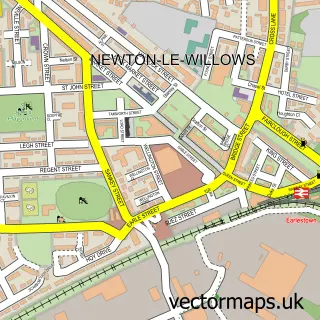
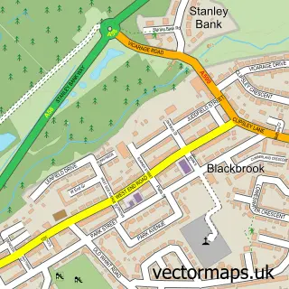
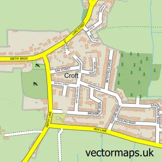
This Burtonwood street map is a detailed vector street map covering a 750m x 750m area. Select a larger area to create and download your own vector street map of Burtonwood.
The 750-metre map sample for Burtonwood covers 500 mapped buildings and approximately 17.9 km of road detail, of which 42 named roads are named. The immediate area includes 1 school, 4 GP surgeries within 2 miles, 1 pub and 1 MOT station, with 10 within 2 miles. The wider area around Burtonwood features 1 tourism point of interest and 3 food and drink venues. To create a larger or custom map of Burtonwood, the map builder lets you define your own coverage area and download editable SVG, PDF and PNG files.
Create a larger editable map of Burtonwood
Choose any area you need and generate a high-quality vector map instantly. Perfect for print, planning, design, business and personal use.

This Burtonwood street map in Cheshire is available as downloadable SVG, PDF and PNG map files, or as a printed map for planning, business, display, education, local information and design work. You can also create a larger custom map area using the map selector.
What this Burtonwood map sample shows
Burtonwood lies within Burtonwood And Westbrook Cp parish, part of Burtonwood And Winwick ward in the Warrington (B) local authority area. The postcode geography for this area includes the WA postcode area, the WA5 postcode district and the WA5 4 postcode sector. Residents fall under the Nhs Cheshire And Merseyside Integrated Care Board for NHS services.
Local features near Burtonwood
Within 2 milesAmenities and services in and around Burtonwood.
Administrative and postcode information for Burtonwood
Burtonwood lies within Burtonwood And Westbrook Cp parish, part of Burtonwood And Winwick ward in the Warrington (B) local authority area. The postcode geography for this area includes the WA postcode area, the WA5 postcode district and the WA5 4 postcode sector. Residents fall under the Nhs Cheshire And Merseyside Integrated Care Board for NHS services.
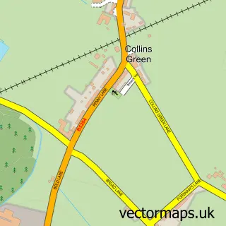
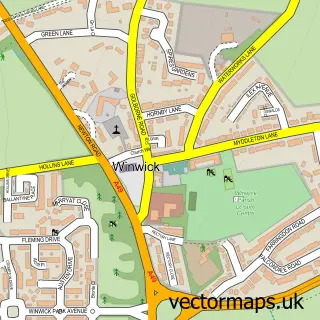
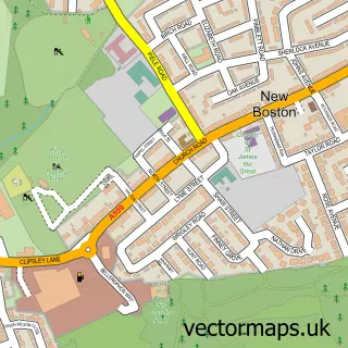
Nearby street map samples around Burtonwood

More street maps in Cheshire
750 metre map area coverage
Boundary, postcode and point of interest information for the 750m x 750m rectangle centred on this sample map.
Boundaries containing map centre
Constituency: Warrington North Co Const
District: Warrington (B)
Icb: NHS Cheshire and Merseyside ICB
Parish: Burtonwood and Westbrook CP
Police Force: cheshire
Postcode District: WA5
Postcode Sector: WA5 4
Ward: Burtonwood & Winwick Ward
Nearby boundaries intersecting sample
No additional intersecting boundaries found.
Postcode coverage
POI category counts
Retail: 5
Building Supply Store: 4
Automotive Repair: 3
Contractor: 3
Driving School: 3
Cleaning Services: 2
It Service And Computer Repair: 2
Korean Grocery Store: 2
Package Locker: 2
Scout Hall: 2
Sample points of interest
- Burtonwood Catholic Club
- St Michael's, Burtonwood
- Acorn Embroidery
- The Raj - Indian Takeaway
- D & G Motors
- D and G Motors
- The Zed Shed
- Sugar Perfection
- Lashes by Jade
- ADM Property Maintenance
- Ace Electrical Services
- Phoenix Joinery
Create a larger editable map of Burtonwood
This sample shows only a 750 metre area. To create a larger map of Burtonwood, use our map builder to choose your own coverage area, add titles and download editable SVG, PDF and PNG files.
Create a custom map of Burtonwood