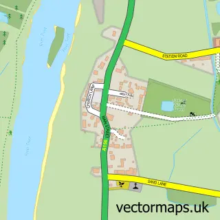
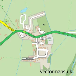
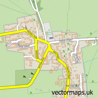
This Fenton street map is a detailed vector street map covering a 750m x 750m area. Select a larger area to create and download your own vector street map of Fenton.
The 750-metre map sample for Fenton covers 126 mapped buildings and approximately 11.3 km of road detail, of which 8 named roads are named. The immediate area includes 1 MOT station within 2 miles. To create a larger or custom map of Fenton, the map builder lets you define your own coverage area and download editable SVG, PDF and PNG files.
Create a larger editable map of Fenton
Choose any area you need and generate a high-quality vector map instantly. Perfect for print, planning, design, business and personal use.

This Fenton street map in Lincolnshire is available as downloadable SVG, PDF and PNG map files, or as a printed map for planning, business, display, education, local information and design work. You can also create a larger custom map area using the map selector.
What this Fenton map sample shows
Fenton lies within Fenton Cp parish, part of Torksey ward in the West Lindsey District local authority area. The postcode geography for this area includes the LN postcode area, the LN1 postcode district and the LN1 2 postcode sector. Residents fall under the Nhs Lincolnshire Integrated Care Board for NHS services.
Local features near Fenton
Within 2 milesAmenities and services in and around Fenton.
Administrative and postcode information for Fenton
The local authority covering Fenton is West Lindsey District, within the county of Lincolnshire. The settlement lies within Torksey ward and Fenton Cp civil parish. The LN1 postcode district and LN1 2 postcode sector serve the immediate area. NHS provision in the area is delivered through United Lincolnshire Hospitals Nhs Trust.
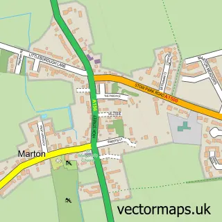
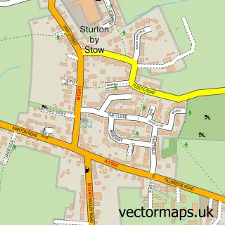
Nearby street map samples around Fenton

More street maps in Lincolnshire
750 metre map area coverage
Boundary, postcode and point of interest information for the 750m x 750m rectangle centred on this sample map.
Boundaries containing map centre
Constituency: Gainsborough Co Const
County: Lincolnshire County
District: West Lindsey District
Icb: NHS Lincolnshire ICB
Parish: Fenton CP
Police Force: lincolnshire
Postcode District: LN1
Postcode Sector: LN1 2
Ward: Torksey Ward
Nearby boundaries intersecting sample
Parish: Kettlethorpe CP
Postcode coverage
POI category counts
Electrical Supply Store: 2
Agricultural Service: 1
Art Gallery: 1
Bar: 1
Boat Storage Facility: 1
Building Supply Store: 1
Fashion: 1
Home Service: 1
Pet Groomer: 1
Plumbing: 1
Sample points of interest
- Hortifeeds
- Original Art
- Carpenters Arms
- Elms Moorings
- Home Sos Network
- Stamar Electronic Services
- Stamar Electronics Ltd.
- Blue Lady Couture
- Lincoln Plumbing & Heating
- Trimmy's Dog and Cat Grooming
- Lincoln Plumbing & Heating Ltd
- Have a Go DIY Training Academy
Create a larger editable map of Fenton
This sample shows only a 750 metre area. To create a larger map of Fenton, use our map builder to choose your own coverage area, add titles and download editable SVG, PDF and PNG files.
Create a custom map of Fenton