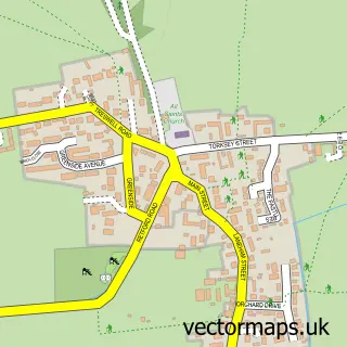
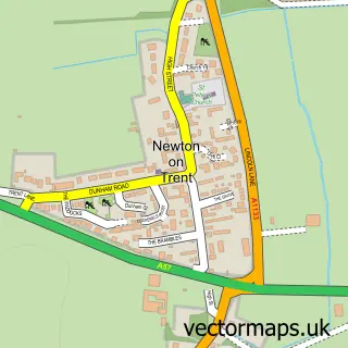
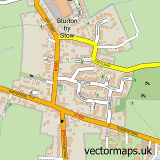
This Torksey street map is a detailed vector street map covering a 750m x 750m area. Select a larger area to create and download your own vector street map of Torksey.
The 750-metre map sample for Torksey covers 87 mapped buildings and approximately 11.8 km of road detail, of which 5 named roads are named. The immediate area includes 1 MOT station within 2 miles. The wider area around Torksey features 2 tourism points of interest, 1 food and drink venue and 1 campsite within 2 miles. To create a larger or custom map of Torksey, the map builder lets you define your own coverage area and download editable SVG, PDF and PNG files.
Create a larger editable map of Torksey
Choose any area you need and generate a high-quality vector map instantly. Perfect for print, planning, design, business and personal use.

This Torksey street map in Lincolnshire is available as downloadable SVG, PDF and PNG map files, or as a printed map for planning, business, display, education, local information and design work. You can also create a larger custom map area using the map selector.
What this Torksey map sample shows
Torksey lies within Torksey Cp parish, part of Torksey ward in the West Lindsey District local authority area. The postcode geography for this area includes the LN postcode area, the LN1 postcode district and the LN1 2 postcode sector. Residents fall under the Nhs Lincolnshire Integrated Care Board for NHS services.
Local features near Torksey
Within 2 milesAmenities and services in and around Torksey.
Administrative and postcode information for Torksey
The local authority covering Torksey is West Lindsey District, within the county of Lincolnshire. The settlement lies within Torksey ward and Torksey Cp civil parish. The LN1 postcode district and LN1 2 postcode sector serve the immediate area. NHS provision in the area is delivered through United Lincolnshire Hospitals Nhs Trust.
Nearby street map samples around Torksey


More street maps in Lincolnshire
750 metre map area coverage
Boundary, postcode and point of interest information for the 750m x 750m rectangle centred on this sample map.
Boundaries containing map centre
Constituency: Gainsborough Co Const
County: Lincolnshire County
District: West Lindsey District
Icb: NHS Lincolnshire ICB
Parish: Torksey CP
Police Force: lincolnshire
Postcode District: LN1
Postcode Sector: LN1 2
Ward: Torksey Ward
Nearby boundaries intersecting sample
Constituency: Newark Co Const
County: Nottinghamshire County
District: Bassetlaw District
Icb: NHS Nottingham and Nottinghamshire ICB
Parish: Rampton and Woodbeck CP
Police Force: nottinghamshire
Postcode District: DN22
Postcode Sector: DN22 0
Ward: Rampton Ward
Postcode coverage
POI category counts
Landmark And Historical Building: 2
Anglican Church: 1
Automotive Repair: 1
Bridge: 1
Church Cathedral: 1
Doctor: 1
Event Technology Service: 1
Home Goods Store: 1
Naturopathic Holistic: 1
Playground: 1
Sample points of interest
- St Peter
- A and G Commercials
- Torksey Viaduct
- St. Peter's Torksey
- Trent Valley Surgery
- Henson Franklyn
- DND Services
- Foss Dyke
- Torksey Castle
- Shamanic Earth with Tracey Coulson
- Torksey Playarea
- The Hume Arms
Create a larger editable map of Torksey
This sample shows only a 750 metre area. To create a larger map of Torksey, use our map builder to choose your own coverage area, add titles and download editable SVG, PDF and PNG files.
Create a custom map of Torksey