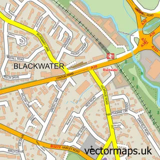
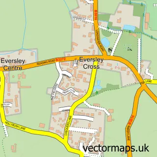
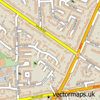
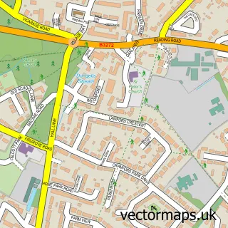
This Frogmore street map is a detailed vector street map covering a 750m x 750m area. Select a larger area to create and download your own vector street map of Frogmore.
The 750-metre map sample for Frogmore covers 504 mapped buildings and approximately 21.2 km of road detail, of which 35 named roads are named. The immediate area includes 1 school, 1 GP surgery, with 2 within 2 miles and 14 MOT stations within 2 miles. The wider area around Frogmore features 2 tourism points of interest and 1 food and drink venue. To create a larger or custom map of Frogmore, the map builder lets you define your own coverage area and download editable SVG, PDF and PNG files.
Create a larger editable map of Frogmore
Choose any area you need and generate a high-quality vector map instantly. Perfect for print, planning, design, business and personal use.

This Frogmore street map in Hampshire is available as downloadable SVG, PDF and PNG map files, or as a printed map for planning, business, display, education, local information and design work. You can also create a larger custom map area using the map selector.
What this Frogmore map sample shows
Frogmore lies within Yateley Cp parish, part of Yateley East ward in the Hart District local authority area. The postcode geography for this area includes the GU postcode area, the GU17 postcode district and the GU17 0 postcode sector. Residents fall under the Nhs Frimley Integrated Care Board for NHS services.
Local features near Frogmore
Within 2 milesAmenities and services in and around Frogmore.
Administrative and postcode information for Frogmore
Frogmore lies within Yateley Cp parish, part of Yateley East ward in the Hart District local authority area. The postcode geography for this area includes the GU postcode area, the GU17 postcode district and the GU17 0 postcode sector. Residents fall under the Nhs Frimley Integrated Care Board for NHS services.
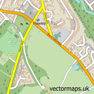
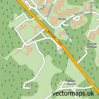
Nearby street map samples around Frogmore

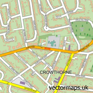
More street maps in Hampshire
750 metre map area coverage
Boundary, postcode and point of interest information for the 750m x 750m rectangle centred on this sample map.
Boundaries containing map centre
Constituency: Aldershot Boro Const
County: Hampshire County
District: Hart District
Icb: NHS Frimley ICB
Parish: Yateley CP
Police Force: hampshire
Postcode District: GU17
Postcode Sector: GU17 0
Ward: Blackwater and Hawley Ward
Nearby boundaries intersecting sample
Parish: Blackwater and Hawley CP
Police Force: thames valley
Ward: Yateley East Ward
Postcode coverage
POI category counts
Professional Services: 4
Doctor: 3
Elementary School: 3
Altering And Remodeling Contractor: 2
Anglican Church: 2
Beauty And Spa: 2
Courier And Delivery Services: 2
Driving School: 2
Engine Repair Service: 2
Forestry Service: 2
Sample points of interest
- Lefevres Chartered Accountants & Chartered Tax Advisers
- County Driveways & Patios
- County Driveways & Patios
- St Barnabas Church
- St Barnabas the Encourager
- Minley Manor Walled Garden
- Aspire Aesthetics UK - Fat Dissolving Camberley
- Velvet Rooms 4 Hair
- Amy Bushnell Lashes, Brows and Beauty
- Blackwater Window Cleaning
- Rogers & Carter Heating Ltd
- Chen's Chinese and Thai Cuisine
Create a larger editable map of Frogmore
This sample shows only a 750 metre area. To create a larger map of Frogmore, use our map builder to choose your own coverage area, add titles and download editable SVG, PDF and PNG files.
Create a custom map of Frogmore