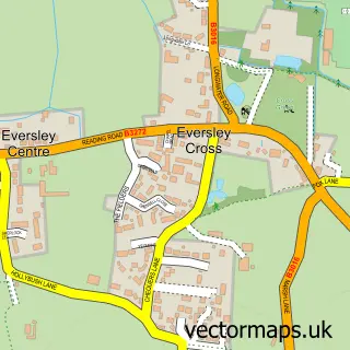
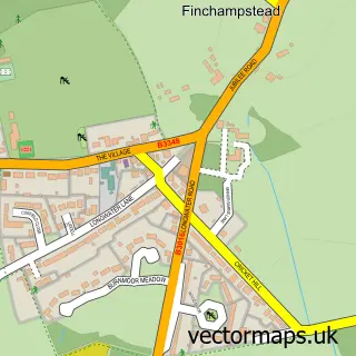
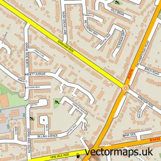
This Yateley street map is a detailed vector street map covering a 750m x 750m area. Select a larger area to create and download your own vector street map of Yateley.
The 750-metre map sample for Yateley covers 398 mapped buildings and approximately 18.1 km of road detail, of which 39 named roads are named. The immediate area includes 3 schools, 1 GP surgery within 2 miles, 2 pubs and 4 MOT stations within 2 miles. The wider area around Yateley features 3 food and drink venues. To create a larger or custom map of Yateley, the map builder lets you define your own coverage area and download editable SVG, PDF and PNG files.
Create a larger editable map of Yateley
Choose any area you need and generate a high-quality vector map instantly. Perfect for print, planning, design, business and personal use.

This Yateley street map in Hampshire is available as downloadable SVG, PDF and PNG map files, or as a printed map for planning, business, display, education, local information and design work. You can also create a larger custom map area using the map selector.
What this Yateley map sample shows
Yateley lies within Yateley Cp parish, part of Yateley East ward in the Hart District local authority area. The postcode geography for this area includes the GU postcode area, the GU46 postcode district and the GU46 6 postcode sector. Residents fall under the Nhs Frimley Integrated Care Board for NHS services.
Local features near Yateley
Within 2 milesAmenities and services in and around Yateley.
Administrative and postcode information for Yateley
Yateley lies within Yateley Cp parish, part of Yateley East ward in the Hart District local authority area. The postcode geography for this area includes the GU postcode area, the GU46 postcode district and the GU46 6 postcode sector. Residents fall under the Nhs Frimley Integrated Care Board for NHS services.
Nearby street map samples around Yateley

More street maps in Hampshire
750 metre map area coverage
Boundary, postcode and point of interest information for the 750m x 750m rectangle centred on this sample map.
Boundaries containing map centre
Constituency: Aldershot Boro Const
County: Hampshire County
District: Hart District
Icb: NHS Frimley ICB
Parish: Yateley CP
Police Force: hampshire
Postcode District: GU46
Postcode Sector: GU46 6
Ward: Yateley East Ward
Nearby boundaries intersecting sample
Constituency: North East Hampshire Co Const
Postcode Sector: GU46 7
Ward: Yateley West Ward
Postcode coverage
POI category counts
Doctor: 5
Funeral Services And Cemeteries: 4
Professional Services: 4
Counseling And Mental Health: 3
Fast Food Restaurant: 3
Gardener: 3
Hair Salon: 3
Pharmacy: 3
Real Estate Agent: 3
Anglican Church: 2
Sample points of interest
- JSM Therapies
- St Peter's Yateley
- St Peters C Of E Church
- Anchor Hanover - Hanover Close
- Yateley Motor Spares
- Motoright
- Greggs
- Lloyds Bank
- Pamper4you
- Serendipity Yateley
- Cafe 46
- Wowbuyanycar
Create a larger editable map of Yateley
This sample shows only a 750 metre area. To create a larger map of Yateley, use our map builder to choose your own coverage area, add titles and download editable SVG, PDF and PNG files.
Create a custom map of Yateley