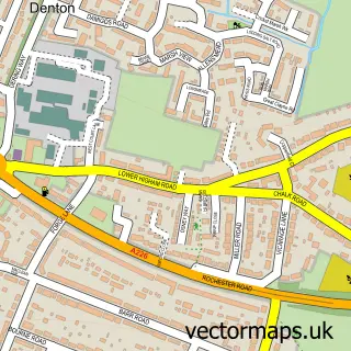
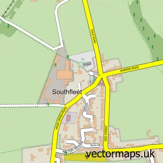
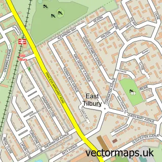
This Gravesend street map is a detailed vector street map covering a 750m x 750m area. Select a larger area to create and download your own vector street map of Gravesend.
The 750-metre map sample for Gravesend covers 225 mapped buildings and approximately 23.7 km of road detail, of which 64 named roads are named. The immediate area includes 1 school, 1 railway station, 2 GP surgeries, with 12 within 2 miles and 19 pubs among other local services. The wider area around Gravesend features 5 tourism points of interest, 57 food and drink venues and 1 hotel. To create a larger or custom map of Gravesend, the map builder lets you define your own coverage area and download editable SVG, PDF and PNG files.
Create a larger editable map of Gravesend
Choose any area you need and generate a high-quality vector map instantly. Perfect for print, planning, design, business and personal use.

This Gravesend street map in Kent is available as downloadable SVG, PDF and PNG map files, or as a printed map for planning, business, display, education, local information and design work. You can also create a larger custom map area using the map selector.
What this Gravesend map sample shows
Gravesend lies within Kent County parish, part of Pelham ward in the Gravesham District (B) local authority area. The postcode geography for this area includes the DA postcode area, the DA11 postcode district and the DA11 0 postcode sector. Residents fall under the Nhs Kent And Medway Integrated Care Board for NHS services.
Local features near Gravesend
Within 2 milesAmenities and services in and around Gravesend.
Administrative and postcode information for Gravesend
The local authority covering Gravesend is Gravesham District (B), within the county of Kent. The settlement lies within Pelham ward and Kent County civil parish. The DA11 postcode district and DA11 0 postcode sector serve the immediate area. NHS provision in the area is delivered through Dartford And Gravesham Nhs Trust.
Nearby street map samples around Gravesend

More street maps in Kent
750 metre map area coverage
Boundary, postcode and point of interest information for the 750m x 750m rectangle centred on this sample map.
Boundaries containing map centre
Constituency: Gravesham Co Const
County: Kent County
District: Gravesham District (B)
Icb: NHS Kent and Medway ICB
Police Force: kent
Postcode District: DA12
Postcode Sector: DA12 2
Ward: Town Ward
Nearby boundaries intersecting sample
Postcode District: DA11
Postcode Sector: DA11 0, DA12 1
Ward: Pelham Ward
Postcode coverage
POI category counts
Hair Salon: 25
Real Estate Agent: 23
Beauty Salon: 21
Clothing Store: 21
Pub: 20
Dentist: 16
Indian Restaurant: 16
Barber: 15
Financial Service: 15
Restaurant: 14
Sample points of interest
- Aggarwal & Co. Chartered Accountants
- B and J Accountants
- Bj Accountants
- MCC Partners Accountants
- Mansion Commercial Finance
- Soldi Partners Accounting
- Advertising Excellence Ltd.
- MSDC
- Blu Eats
- Tasty African Food
- Herbal Palace
- Osteopathic Clinic
Create a larger editable map of Gravesend
This sample shows only a 750 metre area. To create a larger map of Gravesend, use our map builder to choose your own coverage area, add titles and download editable SVG, PDF and PNG files.
Create a custom map of Gravesend