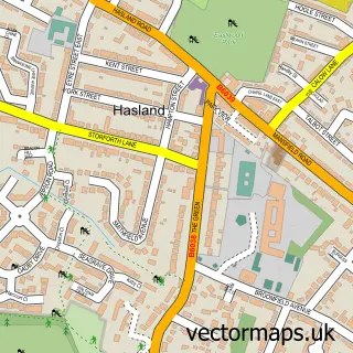
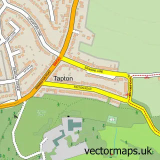
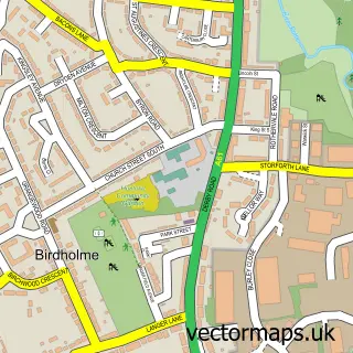
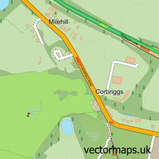
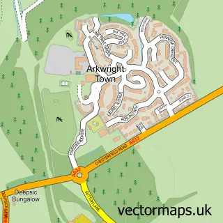
This Hady street map is a detailed vector street map covering a 750m x 750m area. Select a larger area to create and download your own vector street map of Hady.
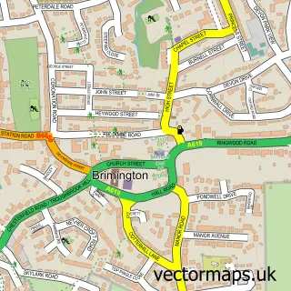
The 750-metre map sample for Hady covers 272 mapped buildings and approximately 12.6 km of road detail, of which 13 named roads are named. The immediate area includes 6 GP surgeries within 2 miles and 20 MOT stations within 2 miles. The wider area around Hady features 1 tourism point of interest. To create a larger or custom map of Hady, the map builder lets you define your own coverage area and download editable SVG, PDF and PNG files.
Create a larger editable map of Hady
Choose any area you need and generate a high-quality vector map instantly. Perfect for print, planning, design, business and personal use.

This Hady street map in Derbyshire is available as downloadable SVG, PDF and PNG map files, or as a printed map for planning, business, display, education, local information and design work. You can also create a larger custom map area using the map selector.
What this Hady map sample shows
Hady lies within Calow Cp parish, part of Sutton ward in the North East Derbyshire District local authority area. The postcode geography for this area includes the S postcode area, the S44 postcode district and the S44 5 postcode sector. Residents fall under the Nhs Derby And Derbyshire Integrated Care Board for NHS services.
Local features near Hady
Within 2 milesAmenities and services in and around Hady.
Administrative and postcode information for Hady
Hady lies within Calow Cp parish, part of Sutton ward in the North East Derbyshire District local authority area. The postcode geography for this area includes the S postcode area, the S44 postcode district and the S44 5 postcode sector. Residents fall under the Nhs Derby And Derbyshire Integrated Care Board for NHS services.
Nearby street map samples around Hady

More street maps in Derbyshire
750 metre map area coverage
Boundary, postcode and point of interest information for the 750m x 750m rectangle centred on this sample map.
Boundaries containing map centre
Constituency: Chesterfield Boro Const
County: Derbyshire County
District: Chesterfield District (B)
Icb: NHS Derby and Derbyshire ICB
Police Force: derbyshire
Postcode District: S41
Postcode Sector: S41 0
Ward: Spire Ward
Nearby boundaries intersecting sample
Constituency: Bolsover Co Const
District: North East Derbyshire District
Parish: Calow CP
Postcode District: S44
Postcode Sector: S44 5
Ward: Hasland Ward, Sutton Ward
Postcode coverage
POI category counts
Retirement Home: 2
Beauty And Spa: 1
Beauty Salon: 1
Brake Service And Repair: 1
Contractor: 1
Education: 1
Elementary School: 1
Engineering Services: 1
Environmental And Ecological Services For Businesses: 1
Home Improvement Store: 1
Sample points of interest
- Taurus Skincare, Wellbeing & Beauty
- The Pamper Pad
- AVG Windscreens - Mobile Windscreen Replacement Chesterfield
- Classic Paving
- S41 Workplace Training
- Hady Primary School
- Fire Check Uk
- Firecheck UK
- Pro Decor Solutions
- Ken Portas Landscaping & Tree Surgery
- Hady Playing Field
- MR Plumbing & Heating
Create a larger editable map of Hady
This sample shows only a 750 metre area. To create a larger map of Hady, use our map builder to choose your own coverage area, add titles and download editable SVG, PDF and PNG files.
Create a custom map of Hady