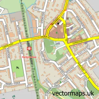
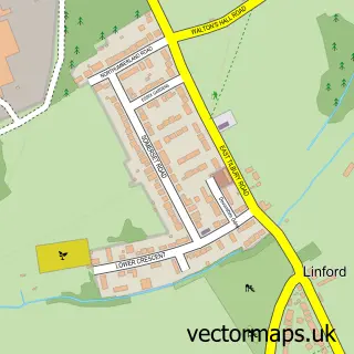
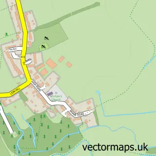
This Horndon On The Hill street map is a detailed vector street map covering a 750m x 750m area. Select a larger area to create and download your own vector street map of Horndon On The Hill.
The 750-metre map sample for Horndon On The Hill covers 331 mapped buildings and approximately 11.6 km of road detail, of which 18 named roads are named. The immediate area includes 1 GP surgery, with 5 within 2 miles, 2 pubs and 6 MOT stations within 2 miles. The wider area around Horndon On The Hill features 2 food and drink venues. To create a larger or custom map of Horndon On The Hill, the map builder lets you define your own coverage area and download editable SVG, PDF and PNG files.
Create a larger editable map of Horndon On The Hill
Choose any area you need and generate a high-quality vector map instantly. Perfect for print, planning, design, business and personal use.

This Horndon On The Hill street map in Essex is available as downloadable SVG, PDF and PNG map files, or as a printed map for planning, business, display, education, local information and design work. You can also create a larger custom map area using the map selector.
What this Horndon On The Hill map sample shows
Horndon On The Hill lies within Thurrock (B) parish, part of Orsett ward in the Thurrock (B) local authority area. The postcode geography for this area includes the SS postcode area, the SS17 postcode district and the SS17 8 postcode sector. Residents fall under the Nhs Mid And South Essex Integrated Care Board for NHS services.
Local features near Horndon On The Hill
Within 2 milesAmenities and services in and around Horndon On The Hill.
Administrative and postcode information for Horndon On The Hill
Horndon On The Hill lies within Thurrock (B) parish, part of Orsett ward in the Thurrock (B) local authority area. The postcode geography for this area includes the SS postcode area, the SS17 postcode district and the SS17 8 postcode sector. Residents fall under the Nhs Mid And South Essex Integrated Care Board for NHS services.
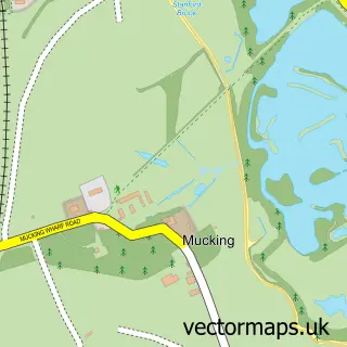
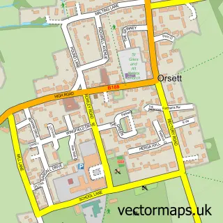
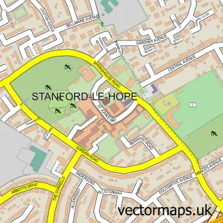
Nearby street map samples around Horndon On The Hill

More street maps in Essex
750 metre map area coverage
Boundary, postcode and point of interest information for the 750m x 750m rectangle centred on this sample map.
Boundaries containing map centre
Constituency: South Basildon and East Thurrock Co Const
District: Thurrock (B)
Icb: NHS Essex ICB
Police Force: essex
Postcode District: SS17
Postcode Sector: SS17 8
Ward: Orsett Ward
Nearby boundaries intersecting sample
No additional intersecting boundaries found.
Postcode coverage
POI category counts
Automotive Repair: 3
Church Cathedral: 2
Doctor: 2
Music Venue: 2
Professional Services: 2
Pub: 2
Anglican Church: 1
Art Gallery: 1
Arts And Entertainment: 1
Auto Upholstery: 1
Sample points of interest
- St Peter & St Paul, Horndon-on-the-Hill
- Lisa Anderson Studio
- Well House Gallery
- Janes Upholstery
- Colin Wilson
- Essex Caravan Breakers
- SCW Tail Lift Services
- Love Beauty Room
- Halls Specialised Services
- Reddingtons Butchers
- Horndon on the Hill Methodist Church
- St. Peter's & St. Paul's Church
Create a larger editable map of Horndon On The Hill
This sample shows only a 750 metre area. To create a larger map of Horndon On The Hill, use our map builder to choose your own coverage area, add titles and download editable SVG, PDF and PNG files.
Create a custom map of Horndon On The Hill