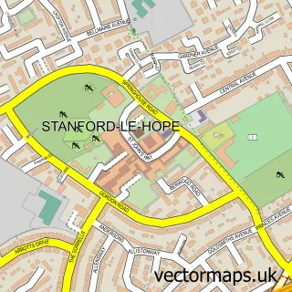
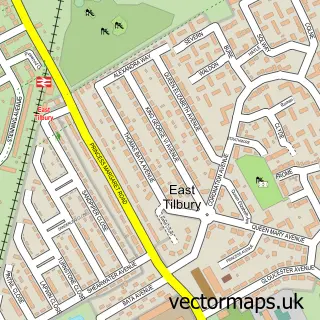
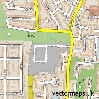
This Stanford-le-Hope street map is a detailed vector street map covering a 750m x 750m area. Select a larger area to create and download your own vector street map of Stanford-le-Hope.
The 750-metre map sample for Stanford-le-Hope covers 504 mapped buildings and approximately 15.5 km of road detail, of which 41 named roads are named. The immediate area includes 1 railway station, 1 GP surgery, with 5 within 2 miles, 6 pubs and 1 MOT station, with 5 within 2 miles. The wider area around Stanford-le-Hope features 13 food and drink venues. To create a larger or custom map of Stanford-le-Hope, the map builder lets you define your own coverage area and download editable SVG, PDF and PNG files.
Create a larger editable map of Stanford-le-Hope
Choose any area you need and generate a high-quality vector map instantly. Perfect for print, planning, design, business and personal use.

This Stanford-le-Hope street map in Essex is available as downloadable SVG, PDF and PNG map files, or as a printed map for planning, business, display, education, local information and design work. You can also create a larger custom map area using the map selector.
What this Stanford-le-Hope map sample shows
Stanford-le-Hope lies within Thurrock (B) parish, part of Stanford-Le-Hope West ward in the Thurrock (B) local authority area. The postcode geography for this area includes the SS postcode area, the SS17 postcode district and the SS17 0 postcode sector. Residents fall under the Nhs Mid And South Essex Integrated Care Board for NHS services.
Local features near Stanford-le-Hope
Within 2 milesAmenities and services in and around Stanford-le-Hope.
Administrative and postcode information for Stanford-le-Hope
The local authority covering Stanford-le-Hope is Thurrock (B), within the county of Essex. The settlement lies within Stanford-Le-Hope West ward and Thurrock (B) civil parish. The SS17 postcode district and SS17 0 postcode sector serve the immediate area. NHS provision in the area is delivered through Mid And South Essex Nhs Foundation Trust.
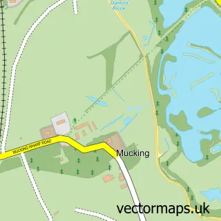
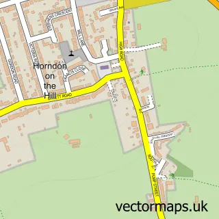
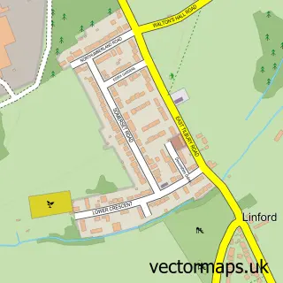
Nearby street map samples around Stanford-le-Hope

More street maps in Essex
750 metre map area coverage
Boundary, postcode and point of interest information for the 750m x 750m rectangle centred on this sample map.
Boundaries containing map centre
Constituency: South Basildon and East Thurrock Co Const
District: Thurrock (B)
Icb: NHS Essex ICB
Police Force: essex
Postcode District: SS17
Postcode Sector: SS17 0
Ward: Stanford-le-Hope West Ward
Nearby boundaries intersecting sample
No additional intersecting boundaries found.
Postcode coverage
POI category counts
Beauty Salon: 7
Gas Station: 7
Barber: 6
Hair Salon: 6
Pub: 6
Automotive Repair: 5
Contractor: 5
Fast Food Restaurant: 5
Indian Restaurant: 5
Professional Services: 5
Sample points of interest
- Vortex Accountants
- St Margaret’s, Stanford-le-Hope
- All About Cats Cattery
- Crafts Unlimited
- Kreeds
- Barclays ATM
- PayPoint
- The Cooperative Food (BF) Stanford Le Hope (ERF)
- Wright Electrics
- IFA Essex
- AP Automotive Essex
- Bench Sound
Create a larger editable map of Stanford-le-Hope
This sample shows only a 750 metre area. To create a larger map of Stanford-le-Hope, use our map builder to choose your own coverage area, add titles and download editable SVG, PDF and PNG files.
Create a custom map of Stanford-le-Hope