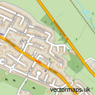
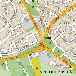
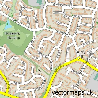
This Horwich street map is a detailed vector street map covering a 750m x 750m area. Select a larger area to create and download your own vector street map of Horwich.
The 750-metre map sample for Horwich covers 414 mapped buildings and approximately 23.0 km of road detail, of which 69 named roads are named. The immediate area includes 2 GP surgeries, 5 pubs and 6 MOT stations, with 14 within 2 miles. The wider area around Horwich features 5 tourism points of interest and 12 food and drink venues. To create a larger or custom map of Horwich, the map builder lets you define your own coverage area and download editable SVG, PDF and PNG files.
Create a larger editable map of Horwich
Choose any area you need and generate a high-quality vector map instantly. Perfect for print, planning, design, business and personal use.

This Horwich street map in Greater Manchester is available as downloadable SVG, PDF and PNG map files, or as a printed map for planning, business, display, education, local information and design work. You can also create a larger custom map area using the map selector.
What this Horwich map sample shows
Horwich lies within Horwich Cp parish, part of Horwich North East ward in the Bolton District (B) local authority area. The postcode geography for this area includes the BL postcode area, the BL6 postcode district and the BL6 7 postcode sector. Residents fall under the Nhs Greater Manchester Integrated Care Board for NHS services.
Local features near Horwich
Within 2 milesAmenities and services in and around Horwich.
Administrative and postcode information for Horwich
The local authority covering Horwich is Bolton District (B), within the county of Greater Manchester. The settlement lies within Horwich North East ward and Horwich Cp civil parish. The BL6 postcode district and BL6 7 postcode sector serve the immediate area. NHS provision in the area is delivered through Bolton Nhs Foundation Trust.
Nearby street map samples around Horwich

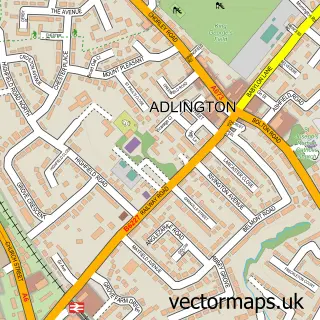
More street maps in Greater Manchester
750 metre map area coverage
Boundary, postcode and point of interest information for the 750m x 750m rectangle centred on this sample map.
Boundaries containing map centre
Constituency: Bolton West Co Const
District: Bolton District (B)
Icb: NHS Greater Manchester ICB
Parish: Horwich CP
Police Force: greater manchester
Postcode District: BL6
Postcode Sector: BL6 5
Ward: Horwich North Ward
Nearby boundaries intersecting sample
Postcode Sector: BL6 6, BL6 7
Ward: Horwich South & Blackrod Ward
Postcode coverage
POI category counts
Beauty Salon: 18
Building Supply Store: 11
Hair Salon: 11
Automotive Repair: 9
Retail: 9
Barber: 8
Real Estate Agent: 8
Flowers And Gifts Shop: 6
Nail Salon: 6
Pet Groomer: 6
Sample points of interest
- Westwell Neary Accountancy
- Piccana
- Armstrongs Enviromental Services Ltd.
- Horwich Youth Darts Club
- St. Catherine's Church, Horwich
- Derian House
- Horwich Auction Rooms
- Sue Ryder
- Experience UK Media Ltd.
- Sugar Lups
- Gerry Halpin
- ATM (Post Office)
Create a larger editable map of Horwich
This sample shows only a 750 metre area. To create a larger map of Horwich, use our map builder to choose your own coverage area, add titles and download editable SVG, PDF and PNG files.
Create a custom map of Horwich