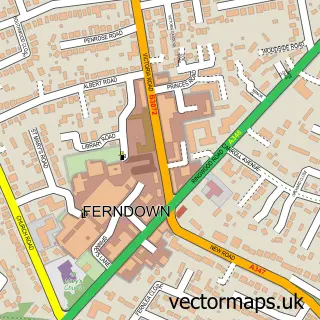
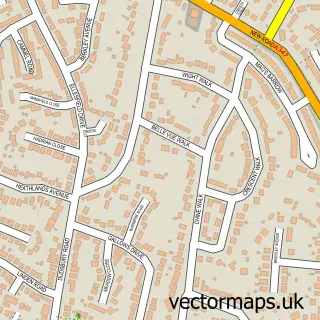
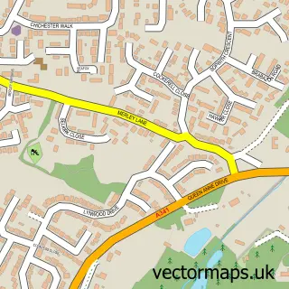
This Kinson street map is a detailed vector street map covering a 750m x 750m area. Select a larger area to create and download your own vector street map of Kinson.
The 750-metre map sample for Kinson covers 551 mapped buildings and approximately 18.5 km of road detail, of which 37 named roads are named. The immediate area includes 1 school, 1 GP surgery, with 6 within 2 miles, 1 pub and 1 MOT station, with 22 within 2 miles. The wider area around Kinson features 3 tourism points of interest and 6 food and drink venues. To create a larger or custom map of Kinson, the map builder lets you define your own coverage area and download editable SVG, PDF and PNG files.
Create a larger editable map of Kinson
Choose any area you need and generate a high-quality vector map instantly. Perfect for print, planning, design, business and personal use.

This Kinson street map in Dorset is available as downloadable SVG, PDF and PNG map files, or as a printed map for planning, business, display, education, local information and design work. You can also create a larger custom map area using the map selector.
What this Kinson map sample shows
Kinson lies within Bournemouth, Christchurch And Poole parish, part of Kinson ward in the Bournemouth, Christchurch And Poole local authority area. The postcode geography for this area includes the BH postcode area, the BH11 postcode district and the BH11 9 postcode sector. Residents fall under the Nhs Dorset Integrated Care Board for NHS services.
Local features near Kinson
Within 2 milesAmenities and services in and around Kinson.
Administrative and postcode information for Kinson
The local authority covering Kinson is Bournemouth, Christchurch And Poole, within the county of Dorset. The settlement lies within Kinson ward and Bournemouth, Christchurch And Poole civil parish. The BH11 postcode district and BH11 9 postcode sector serve the immediate area. NHS provision in the area is delivered through University Hospitals Dorset Nhs Foundation Trust.
Nearby street map samples around Kinson

More street maps in Dorset
750 metre map area coverage
Boundary, postcode and point of interest information for the 750m x 750m rectangle centred on this sample map.
Boundaries containing map centre
Constituency: Bournemouth West Boro Const
District: Bournemouth, Christchurch and Poole
Icb: NHS Dorset ICB
Police Force: dorset
Postcode District: BH10
Postcode Sector: BH10 7
Ward: Kinson Ward
Nearby boundaries intersecting sample
Postcode District: BH11
Postcode Sector: BH10 5, BH11 8, BH11 9
Postcode coverage
POI category counts
Doctor: 5
Funeral Services And Cemeteries: 5
Gym: 5
Fast Food Restaurant: 4
Pet Store: 4
Professional Services: 4
Automotive Repair: 3
Barber: 3
Beauty And Spa: 3
Beauty Salon: 3
Sample points of interest
- Bash's Speed Shop
- St Andrew's Kinson
- Staffie & Stray Rescue
- Staffie and Stray Rescue - Charity Shop Kinson
- Bluecross Domestics
- Kitchen Appliances
- Danny Cartoons
- Great Oaks Care Home
- Chrome Cruisers Ltd
- Chrome Cruisers Limited
- Dentz
- Kinson MOT Centre
Create a larger editable map of Kinson
This sample shows only a 750 metre area. To create a larger map of Kinson, use our map builder to choose your own coverage area, add titles and download editable SVG, PDF and PNG files.
Create a custom map of Kinson