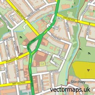
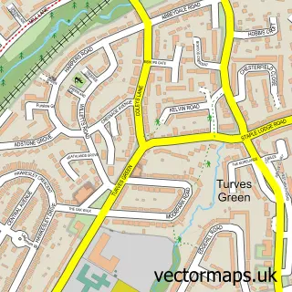
This Lifford street map is a detailed vector street map covering a 750m x 750m area. Select a larger area to create and download your own vector street map of Lifford.
The 750-metre map sample for Lifford covers 217 mapped buildings and approximately 22.8 km of road detail, of which 23 named roads are named. The immediate area includes 1 school, 16 GP surgeries within 2 miles and 4 MOT stations, with 32 within 2 miles. The wider area around Lifford features 2 tourism points of interest, 3 food and drink venues and 1 hotel. To create a larger or custom map of Lifford, the map builder lets you define your own coverage area and download editable SVG, PDF and PNG files.
Create a larger editable map of Lifford
Choose any area you need and generate a high-quality vector map instantly. Perfect for print, planning, design, business and personal use.

This Lifford street map in West Midlands is available as downloadable SVG, PDF and PNG map files, or as a printed map for planning, business, display, education, local information and design work. You can also create a larger custom map area using the map selector.
What this Lifford map sample shows
Lifford lies within Birmingham District (B) parish, part of King's Norton South ward in the Birmingham District (B) local authority area. The postcode geography for this area includes the B postcode area, the B30 postcode district and the B30 3 postcode sector. Residents fall under the Nhs Birmingham And Solihull Integrated Care Board for NHS services.
Local features near Lifford
Within 2 milesAmenities and services in and around Lifford.
Administrative and postcode information for Lifford
Lifford lies within Birmingham District (B) parish, part of King's Norton South ward in the Birmingham District (B) local authority area. The postcode geography for this area includes the B postcode area, the B30 postcode district and the B30 3 postcode sector. Residents fall under the Nhs Birmingham And Solihull Integrated Care Board for NHS services.
Nearby street map samples around Lifford


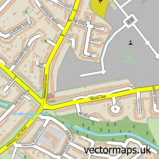
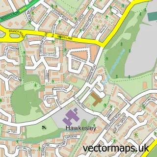
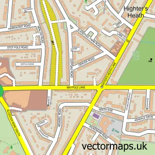
More street maps in West Midlands
750 metre map area coverage
Boundary, postcode and point of interest information for the 750m x 750m rectangle centred on this sample map.
Boundaries containing map centre
Constituency: Birmingham Northfield Boro Const
District: Birmingham District (B)
Icb: NHS Birmingham and Solihull ICB
Police Force: west midlands
Postcode District: B30
Postcode Sector: B30 3
Ward: King's Norton North Ward
Nearby boundaries intersecting sample
Constituency: Birmingham Selly Oak Boro Const
Postcode District: B14
Postcode Sector: B14 6, B30 2
Ward: Brandwood & King's Heath Ward, Druids Heath & Monyhull Ward, Stirchley Ward
Postcode coverage
POI category counts
Automotive Repair: 14
Building Supply Store: 6
Retail: 5
Gas Station: 4
Bar: 3
Industrial Equipment: 3
Music Venue: 3
Accountant: 2
Appliance Store: 2
Arts And Crafts: 2
Sample points of interest
- Lifford Hall
- Stanley Yule
- Clear Channel Direct Birmingham
- D C Sewing Machines And Haberdashery
- Haberdashery And Sewing Machine Supplies
- J.J.D. Cards
- hsmsupplies.com
- SGN Ltd - Beaumont Filling Station (TGC), Kings Norton
- SDJ Cars
- Tappers Upholstery
- Mechatronic Solutions UK
- Euro Car Parts
Create a larger editable map of Lifford
This sample shows only a 750 metre area. To create a larger map of Lifford, use our map builder to choose your own coverage area, add titles and download editable SVG, PDF and PNG files.
Create a custom map of Lifford