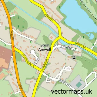
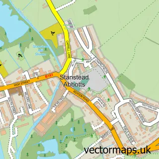
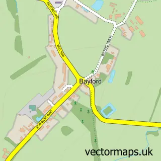
This Little Amwell street map is a detailed vector street map covering a 750m x 750m area. Select a larger area to create and download your own vector street map of Little Amwell.
The 750-metre map sample for Little Amwell covers 260 mapped buildings and approximately 10.2 km of road detail, of which 17 named roads are named. The immediate area includes 1 school, 5 GP surgeries within 2 miles, 1 pub and 13 MOT stations within 2 miles. The wider area around Little Amwell features 2 food and drink venues and 1 campsite within 2 miles. To create a larger or custom map of Little Amwell, the map builder lets you define your own coverage area and download editable SVG, PDF and PNG files.
Create a larger editable map of Little Amwell
Choose any area you need and generate a high-quality vector map instantly. Perfect for print, planning, design, business and personal use.

This Little Amwell street map in Hertfordshire is available as downloadable SVG, PDF and PNG map files, or as a printed map for planning, business, display, education, local information and design work. You can also create a larger custom map area using the map selector.
What this Little Amwell map sample shows
Little Amwell lies within Hertford Heath Cp parish, part of Hertford Heath ward in the East Hertfordshire District local authority area. The postcode geography for this area includes the SG postcode area, the SG13 postcode district and the SG13 7 postcode sector. Residents fall under the Nhs Hertfordshire And West Essex Integrated Care Board for NHS services.
Local features near Little Amwell
Within 2 milesAmenities and services in and around Little Amwell.
Administrative and postcode information for Little Amwell
The local authority covering Little Amwell is East Hertfordshire District, within the county of Hertfordshire. The settlement lies within Hertford Heath ward and Hertford Heath Cp civil parish. The SG13 postcode district and SG13 7 postcode sector serve the immediate area. NHS provision in the area is delivered through The Princess Alexandra Hospital Nhs Trust.
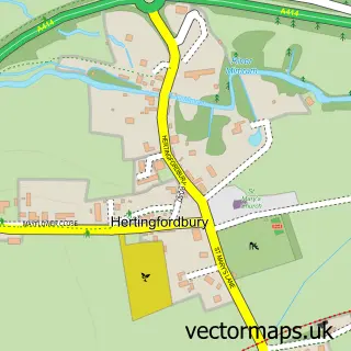
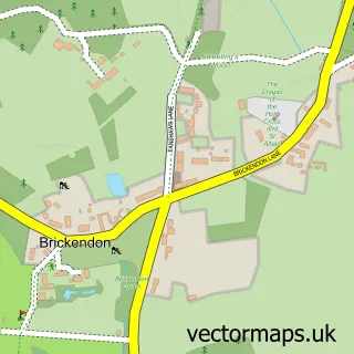
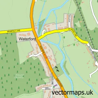
Nearby street map samples around Little Amwell

More street maps in Hertfordshire
750 metre map area coverage
Boundary, postcode and point of interest information for the 750m x 750m rectangle centred on this sample map.
Boundaries containing map centre
Constituency: Broxbourne Co Const
County: Hertfordshire County
District: East Hertfordshire District
Icb: NHS Central East ICB
Parish: Hertford Heath CP
Police Force: hertfordshire
Postcode District: SG13
Postcode Sector: SG13 7
Ward: Hertford Heath & Brickendon Ward
Nearby boundaries intersecting sample
Constituency: Hertford and Stortford Co Const
Parish: Hertford CP
Ward: Hertford Castle Ward
Postcode coverage
POI category counts
Freight And Cargo Service: 2
Accountant: 1
Advertising Agency: 1
Arts And Entertainment: 1
Building Supply Store: 1
Candy Store: 1
Church Cathedral: 1
Cleaning Services: 1
Community Center: 1
Construction Services: 1
Sample points of interest
- Angels and Ledgers
- Two's Company Design
- Blackdog Games Ltd
- Green Days Garden Services
- Lindsay Sweets
- Holy Trinity Church
- Maids of Herts
- The Village Green - Hertford Heath
- First Class Construction Ltd
- Black Dog Leisure
- Dawlicious Milk
- Hertford Heath Junior Mixed Infant School
Create a larger editable map of Little Amwell
This sample shows only a 750 metre area. To create a larger map of Little Amwell, use our map builder to choose your own coverage area, add titles and download editable SVG, PDF and PNG files.
Create a custom map of Little Amwell