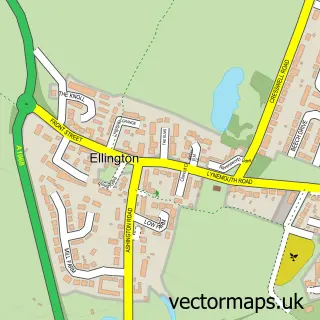
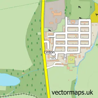
This Lynemouth street map is a detailed vector street map covering a 750m x 750m area. Select a larger area to create and download your own vector street map of Lynemouth.
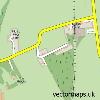
The 750-metre map sample for Lynemouth covers 189 mapped buildings and approximately 18.8 km of road detail, of which 12 named roads are named. The immediate area includes 1 school. The wider area around Lynemouth features 1 tourism point of interest and 1 food and drink venue. To create a larger or custom map of Lynemouth, the map builder lets you define your own coverage area and download editable SVG, PDF and PNG files.
Create a larger editable map of Lynemouth
Choose any area you need and generate a high-quality vector map instantly. Perfect for print, planning, design, business and personal use.

This Lynemouth street map in Northumberland is available as downloadable SVG, PDF and PNG map files, or as a printed map for planning, business, display, education, local information and design work. You can also create a larger custom map area using the map selector.
What this Lynemouth map sample shows
Lynemouth lies within Lynemouth Cp parish, part of Lynemouth ward in the Northumberland local authority area. The postcode geography for this area includes the NE postcode area, the NE61 postcode district and the NE61 5 postcode sector. Residents fall under the Nhs North East And North Cumbria Integrated Care Board for NHS services.
Local features near Lynemouth
Within 2 milesAmenities and services in and around Lynemouth.
Administrative and postcode information for Lynemouth
Lynemouth lies within Lynemouth Cp parish, part of Lynemouth ward in the Northumberland local authority area. The postcode geography for this area includes the NE postcode area, the NE61 postcode district and the NE61 5 postcode sector. Residents fall under the Nhs North East And North Cumbria Integrated Care Board for NHS services.
Nearby street map samples around Lynemouth

More street maps in Northumberland
750 metre map area coverage
Boundary, postcode and point of interest information for the 750m x 750m rectangle centred on this sample map.
Boundaries containing map centre
Constituency: North Northumberland Co Const
District: Northumberland
Icb: NHS North East and North Cumbria ICB
Parish: Lynemouth CP
Police Force: northumberland
Postcode District: NE61
Postcode Sector: NE61 5
Nearby boundaries intersecting sample
Parish: Cresswell CP, Ellington and Linton CP
Postcode coverage
POI category counts
Beauty Salon: 2
Flowers And Gifts Shop: 2
Library: 2
Professional Services: 2
Art Gallery: 1
Barber: 1
Car Wash: 1
Child Care And Day Care: 1
Chinese Restaurant: 1
Coffee Shop: 1
Sample points of interest
- The SAN Gallery
- Turkish Barbers
- Coastlyne hair,beauty&aesthetics training centre
- Jordans hair design
- Lynemouth Car Wash
- Lynemouth Day Centre
- Riverside Chinese Takeaway
- Calmer Café CIC
- Lynemouth Day Centre
- Lynemouth Surgery
- Lynemouth County First School
- NCEA William Leech C of E Primary School NE61 5TR
Create a larger editable map of Lynemouth
This sample shows only a 750 metre area. To create a larger map of Lynemouth, use our map builder to choose your own coverage area, add titles and download editable SVG, PDF and PNG files.
Create a custom map of Lynemouth