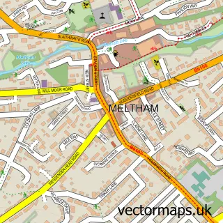
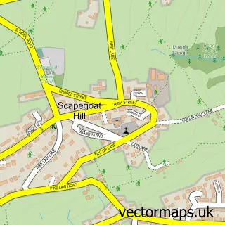
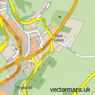
This Marsden street map is a detailed vector street map covering a 750m x 750m area. Select a larger area to create and download your own vector street map of Marsden.
The 750-metre map sample for Marsden covers 255 mapped buildings and approximately 20.0 km of road detail, of which 38 named roads are named. The immediate area includes 2 schools, 1 railway station, 5 pubs and 1 MOT station within 2 miles. The wider area around Marsden features 3 tourism points of interest and 11 food and drink venues. To create a larger or custom map of Marsden, the map builder lets you define your own coverage area and download editable SVG, PDF and PNG files.
Create a larger editable map of Marsden
Choose any area you need and generate a high-quality vector map instantly. Perfect for print, planning, design, business and personal use.

This Marsden street map in West Yorkshire is available as downloadable SVG, PDF and PNG map files, or as a printed map for planning, business, display, education, local information and design work. You can also create a larger custom map area using the map selector.
What this Marsden map sample shows
Marsden lies within Kirklees District (B) parish, part of Colne Valley ward in the Kirklees District (B) local authority area. The postcode geography for this area includes the HD postcode area, the HD7 postcode district and the HD7 6 postcode sector. Residents fall under the Nhs West Yorkshire Integrated Care Board for NHS services.
Local features near Marsden
Within 2 milesAmenities and services in and around Marsden.
Administrative and postcode information for Marsden
Marsden lies within Kirklees District (B) parish, part of Colne Valley ward in the Kirklees District (B) local authority area. The postcode geography for this area includes the HD postcode area, the HD7 postcode district and the HD7 6 postcode sector. Residents fall under the Nhs West Yorkshire Integrated Care Board for NHS services.
Nearby street map samples around Marsden

More street maps in West Yorkshire
750 metre map area coverage
Boundary, postcode and point of interest information for the 750m x 750m rectangle centred on this sample map.
Boundaries containing map centre
Constituency: Colne Valley Co Const
District: Kirklees District (B)
Icb: NHS West Yorkshire ICB
Police Force: west yorkshire
Postcode District: HD7
Postcode Sector: HD7 6
Ward: Colne Valley Ward
Nearby boundaries intersecting sample
No additional intersecting boundaries found.
Postcode coverage
POI category counts
Counseling And Mental Health: 5
Pub: 5
Bar: 3
Beauty Salon: 3
Building Supply Store: 3
Cafe: 3
Church Cathedral: 3
Community Services Non Profits: 3
Education: 3
Hair Salon: 3
Sample points of interest
- Village Green
- Huddersfield Stoves
- Enjoy Art
- Marsden Art Studio
- Hanson Music & Arts
- ATM (Post Office)
- The Cooperative Food (BF) Marsden, Marsden
- Marsden Moor
- Auto Finish
- It Repair Guys
- Marsden Bakery
- Roger's Bakery
Create a larger editable map of Marsden
This sample shows only a 750 metre area. To create a larger map of Marsden, use our map builder to choose your own coverage area, add titles and download editable SVG, PDF and PNG files.
Create a custom map of Marsden