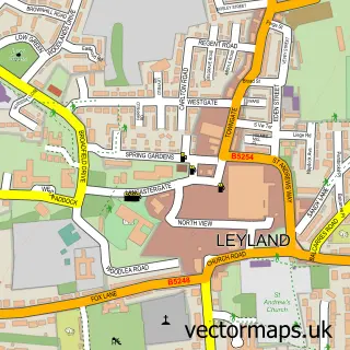
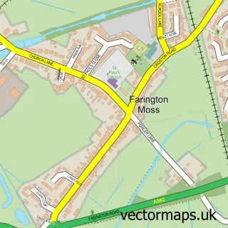
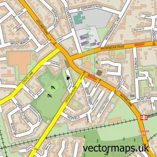
This Midge Hall street map is a detailed vector street map covering a 750m x 750m area. Select a larger area to create and download your own vector street map of Midge Hall.
The 750-metre map sample for Midge Hall covers 285 mapped buildings and approximately 11.6 km of road detail, of which 4 named roads are named. The immediate area includes 5 GP surgeries within 2 miles, 1 pub and 14 MOT stations within 2 miles. The wider area around Midge Hall features 1 food and drink venue. To create a larger or custom map of Midge Hall, the map builder lets you define your own coverage area and download editable SVG, PDF and PNG files.
Create a larger editable map of Midge Hall
Choose any area you need and generate a high-quality vector map instantly. Perfect for print, planning, design, business and personal use.

This Midge Hall street map in Lancashire is available as downloadable SVG, PDF and PNG map files, or as a printed map for planning, business, display, education, local information and design work. You can also create a larger custom map area using the map selector.
What this Midge Hall map sample shows
Midge Hall lies within Lancashire County parish, part of Moss Side ward in the South Ribble District (B) local authority area. The postcode geography for this area includes the PR postcode area, the PR26 postcode district and the PR26 6 postcode sector. Residents fall under the Nhs Lancashire And South Cumbria Integrated Care Board for NHS services.
Local features near Midge Hall
Within 2 milesAmenities and services in and around Midge Hall.
Administrative and postcode information for Midge Hall
Midge Hall lies within Lancashire County parish, part of Moss Side ward in the South Ribble District (B) local authority area. The postcode geography for this area includes the PR postcode area, the PR26 postcode district and the PR26 6 postcode sector. Residents fall under the Nhs Lancashire And South Cumbria Integrated Care Board for NHS services.
Nearby street map samples around Midge Hall

More street maps in Lancashire
750 metre map area coverage
Boundary, postcode and point of interest information for the 750m x 750m rectangle centred on this sample map.
Boundaries containing map centre
Constituency: South Ribble Co Const
County: Lancashire County
District: South Ribble District (B)
Icb: NHS Lancashire and South Cumbria ICB
Police Force: lancashire
Postcode District: PR26
Postcode Sector: PR26 6
Ward: Moss Side Ward
Nearby boundaries intersecting sample
Postcode Sector: PR26 7
Postcode coverage
POI category counts
Paintball: 2
Pet Store: 2
Retail: 2
Auto Body Shop: 1
Beauty And Spa: 1
Building Supply Store: 1
Church Cathedral: 1
Computer Store: 1
Dog Park: 1
Home Developer: 1
Sample points of interest
- H Parkinson Land Rovers
- Hi brows by Tonia
- A P Broome Landscapes
- Midge Hall Methodist Church
- Laptop Bits Ltd.
- Midge Hall Secure Dog Field
- Barratt Homes - Centurion Village
- Olicana Cleaning Services
- Christie Heating Services
- Solis Blinds
- InPost
- Go Ballistic
Create a larger editable map of Midge Hall
This sample shows only a 750 metre area. To create a larger map of Midge Hall, use our map builder to choose your own coverage area, add titles and download editable SVG, PDF and PNG files.
Create a custom map of Midge Hall