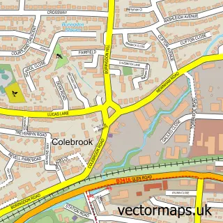
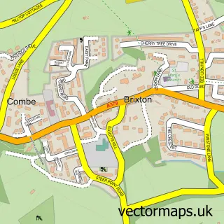
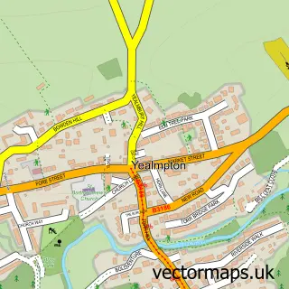
This Plympton street map is a detailed vector street map covering a 750m x 750m area. Select a larger area to create and download your own vector street map of Plympton.
The 750-metre map sample for Plympton covers 393 mapped buildings and approximately 20.1 km of road detail, of which 50 named roads are named. The immediate area includes 2 schools, 2 GP surgeries within 2 miles, 6 pubs and 1 MOT station, with 20 within 2 miles. The wider area around Plympton features 2 tourism points of interest, 9 food and drink venues and 1 hotel. To create a larger or custom map of Plympton, the map builder lets you define your own coverage area and download editable SVG, PDF and PNG files.
Create a larger editable map of Plympton
Choose any area you need and generate a high-quality vector map instantly. Perfect for print, planning, design, business and personal use.

This Plympton street map in Devon is available as downloadable SVG, PDF and PNG map files, or as a printed map for planning, business, display, education, local information and design work. You can also create a larger custom map area using the map selector.
What this Plympton map sample shows
Plympton lies within City Of Plymouth (B) parish, part of Plympton Erle ward in the City Of Plymouth (B) local authority area. The postcode geography for this area includes the PL postcode area, the PL7 postcode district and the PL7 2 postcode sector. Residents fall under the Nhs Devon Integrated Care Board for NHS services.
Local features near Plympton
Within 2 milesAmenities and services in and around Plympton.
Administrative and postcode information for Plympton
The local authority covering Plympton is City Of Plymouth (B), within the county of Devon. The settlement lies within Plympton Erle ward and City Of Plymouth (B) civil parish. The PL7 postcode district and PL7 2 postcode sector serve the immediate area. NHS provision in the area is delivered through University Hospitals Plymouth Nhs Trust.
Nearby street map samples around Plympton

More street maps in Devon
750 metre map area coverage
Boundary, postcode and point of interest information for the 750m x 750m rectangle centred on this sample map.
Boundaries containing map centre
Constituency: South West Devon Co Const
District: City of Plymouth (B)
Icb: NHS Devon ICB
Police Force: devon and cornwall
Postcode District: PL7
Postcode Sector: PL7 2
Ward: Plympton St. Mary Ward
Nearby boundaries intersecting sample
Postcode Sector: PL7 1, PL7 4
Ward: Plympton Erle Ward
Postcode coverage
POI category counts
Pub: 6
Automotive Repair: 5
Beauty Salon: 4
Coffee Shop: 3
Convenience Store: 3
Funeral Services And Cemeteries: 3
Post Office: 3
Preschool: 3
Retirement Home: 3
Auto Glass Service: 2
Sample points of interest
- Plympton St Mary Church
- Woodside Animal Welfare Trust - Charity Shops
- Asian Box Takeaway
- Peninsula Care Homes
- Sunrise Windows (Plymouth) Ltd.
- Sunrise Windows Plymouth
- AJ Motors (Plympton) Ltd
- Local Windscreen Replacement Plymouth
- Local windscreens Plymouth
- Ron & Derek Sluman
- Unipart Car Care Centre
- Oggy Oggy Pasty Co.
Create a larger editable map of Plympton
This sample shows only a 750 metre area. To create a larger map of Plympton, use our map builder to choose your own coverage area, add titles and download editable SVG, PDF and PNG files.
Create a custom map of Plympton