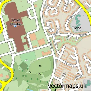
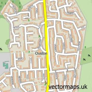
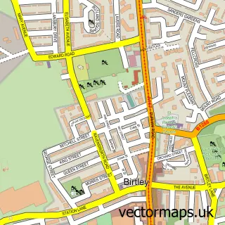
This Springwell street map is a detailed vector street map covering a 750m x 750m area. Select a larger area to create and download your own vector street map of Springwell.
The 750-metre map sample for Springwell covers 383 mapped buildings and approximately 14.4 km of road detail, of which 19 named roads are named. The immediate area includes 1 school, 8 GP surgeries within 2 miles, 1 pub and 11 MOT stations within 2 miles. The wider area around Springwell features 3 tourism points of interest and 1 food and drink venue. To create a larger or custom map of Springwell, the map builder lets you define your own coverage area and download editable SVG, PDF and PNG files.
Create a larger editable map of Springwell
Choose any area you need and generate a high-quality vector map instantly. Perfect for print, planning, design, business and personal use.

This Springwell street map in Tyne & Wear is available as downloadable SVG, PDF and PNG map files, or as a printed map for planning, business, display, education, local information and design work. You can also create a larger custom map area using the map selector.
What this Springwell map sample shows
Springwell lies within Gateshead District (B) parish, part of High Fell ward in the Gateshead District (B) local authority area. The postcode geography for this area includes the NE postcode area, the NE9 postcode district and the NE9 7 postcode sector. Residents fall under the Nhs North East And North Cumbria Integrated Care Board for NHS services.
Local features near Springwell
Within 2 milesAmenities and services in and around Springwell.
Administrative and postcode information for Springwell
Springwell lies within Gateshead District (B) parish, part of High Fell ward in the Gateshead District (B) local authority area. The postcode geography for this area includes the NE postcode area, the NE9 postcode district and the NE9 7 postcode sector. Residents fall under the Nhs North East And North Cumbria Integrated Care Board for NHS services.
Nearby street map samples around Springwell


More street maps in Tyne & Wear
750 metre map area coverage
Boundary, postcode and point of interest information for the 750m x 750m rectangle centred on this sample map.
Boundaries containing map centre
Constituency: Washington and Gateshead South Boro Const
District: Sunderland District (B)
Icb: NHS North East and North Cumbria ICB
Police Force: northumberland
Postcode District: NE9
Postcode Sector: NE9 7
Ward: Washington West Ward
Nearby boundaries intersecting sample
No additional intersecting boundaries found.
Postcode coverage
POI category counts
Building Supply Store: 4
Beauty Salon: 2
Key And Locksmith: 2
Landmark And Historical Building: 2
Active Life: 1
Advertising Agency: 1
Auto Upholstery: 1
Carpet Cleaning: 1
Church Cathedral: 1
Community Center: 1
Sample points of interest
- All Round Cricket Coachinguk
- tent
- Finesse Furnishings
- Beauty Over The Road
- Style Lynz
- ASAP Plumbing & Heating
- Corbett's Skip Hire
- Insink Plumbing
- Tyneside Minimix Concrete
- White Mare Services
- Springwell Methodist Church
- Springwell Village Community Venue
Create a larger editable map of Springwell
This sample shows only a 750 metre area. To create a larger map of Springwell, use our map builder to choose your own coverage area, add titles and download editable SVG, PDF and PNG files.
Create a custom map of Springwell