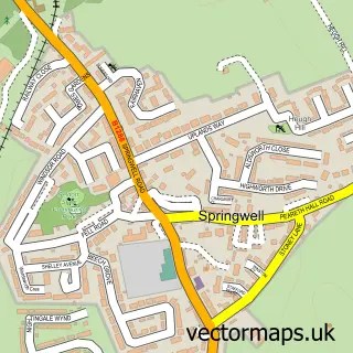
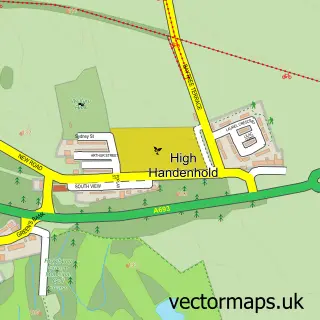
This Lamesley street map is a detailed vector street map covering a 750m x 750m area. Select a larger area to create and download your own vector street map of Lamesley.
The 750-metre map sample for Lamesley covers 27 mapped buildings and approximately 12.1 km of road detail, of which 2 named roads are named. The immediate area includes 4 GP surgeries within 2 miles, 1 pub and 14 MOT stations within 2 miles. The wider area around Lamesley features 1 food and drink venue and 1 hotel. To create a larger or custom map of Lamesley, the map builder lets you define your own coverage area and download editable SVG, PDF and PNG files.
Create a larger editable map of Lamesley
Choose any area you need and generate a high-quality vector map instantly. Perfect for print, planning, design, business and personal use.

This Lamesley street map in Tyne & Wear is available as downloadable SVG, PDF and PNG map files, or as a printed map for planning, business, display, education, local information and design work. You can also create a larger custom map area using the map selector.
What this Lamesley map sample shows
Lamesley lies within Lamesley Cp parish, part of Lamesley ward in the Gateshead District (B) local authority area. The postcode geography for this area includes the NE postcode area, the NE11 postcode district and the NE11 0 postcode sector. Residents fall under the Nhs North East And North Cumbria Integrated Care Board for NHS services.
Local features near Lamesley
Within 2 milesAmenities and services in and around Lamesley.
Administrative and postcode information for Lamesley
Lamesley lies within Lamesley Cp parish, part of Lamesley ward in the Gateshead District (B) local authority area. The postcode geography for this area includes the NE postcode area, the NE11 postcode district and the NE11 0 postcode sector. Residents fall under the Nhs North East And North Cumbria Integrated Care Board for NHS services.
Nearby street map samples around Lamesley
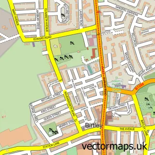

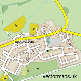
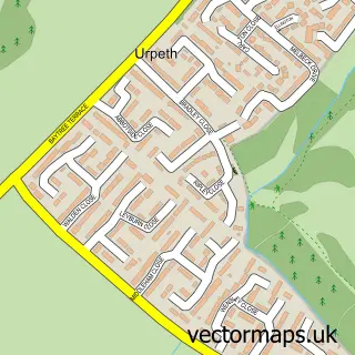
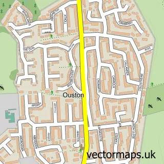
More street maps in Tyne & Wear
750 metre map area coverage
Boundary, postcode and point of interest information for the 750m x 750m rectangle centred on this sample map.
Boundaries containing map centre
Constituency: Washington and Gateshead South Boro Const
District: Gateshead District (B)
Icb: NHS North East and North Cumbria ICB
Parish: Lamesley CP
Police Force: northumberland
Postcode District: NE11
Postcode Sector: NE11 0
Ward: Lamesley Ward
Nearby boundaries intersecting sample
No additional intersecting boundaries found.
Postcode coverage
POI category counts
Church Cathedral: 3
Arts And Entertainment: 1
Business: 1
Contractor: 1
Hotel: 1
Parking: 1
Pub: 1
Resort: 1
Sports And Recreation Venue: 1
Tire Dealer And Repair: 1
Sample points of interest
- The Ravensworth Arms, Lamesley
- Lamesley Childcare
- Lamesley Church St Andrews
- Newcastle Marthoma Prayer Fellowship
- St Andrew's Church
- J Straughan
- Hot Tub Hideaway
- Lamesley Pastures
- Ravensworth Arms
- The Ravensworth Arms
- Gateshead Quad Bikes and outdoor pursuits
- Eileen’s
Create a larger editable map of Lamesley
This sample shows only a 750 metre area. To create a larger map of Lamesley, use our map builder to choose your own coverage area, add titles and download editable SVG, PDF and PNG files.
Create a custom map of Lamesley