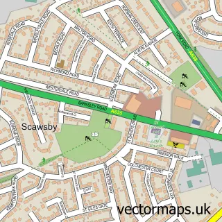
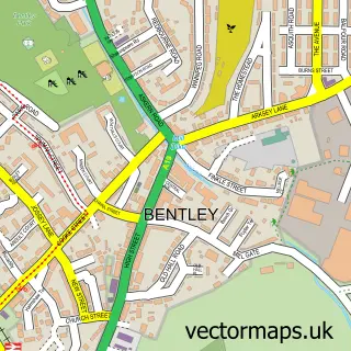
This Sprotbrough street map is a detailed vector street map covering a 750m x 750m area. Select a larger area to create and download your own vector street map of Sprotbrough.
The 750-metre map sample for Sprotbrough covers 458 mapped buildings and approximately 15.0 km of road detail, of which 33 named roads are named. The immediate area includes 1 school, 4 GP surgeries within 2 miles, 2 pubs and 17 MOT stations within 2 miles. The wider area around Sprotbrough features 4 food and drink venues. To create a larger or custom map of Sprotbrough, the map builder lets you define your own coverage area and download editable SVG, PDF and PNG files.
Create a larger editable map of Sprotbrough
Choose any area you need and generate a high-quality vector map instantly. Perfect for print, planning, design, business and personal use.

This Sprotbrough street map in South Yorkshire is available as downloadable SVG, PDF and PNG map files, or as a printed map for planning, business, display, education, local information and design work. You can also create a larger custom map area using the map selector.
What this Sprotbrough map sample shows
Sprotbrough lies within Sprotbrough And Cusworth Cp parish, part of Sprotbrough ward in the Doncaster District (B) local authority area. The postcode geography for this area includes the DN postcode area, the DN5 postcode district and the DN5 7 postcode sector. Residents fall under the Nhs South Yorkshire Integrated Care Board for NHS services.
Local features near Sprotbrough
Within 2 milesAmenities and services in and around Sprotbrough.
Administrative and postcode information for Sprotbrough
The local authority covering Sprotbrough is Doncaster District (B), within the county of South Yorkshire. The settlement lies within Sprotbrough ward and Sprotbrough And Cusworth Cp civil parish. The DN5 postcode district and DN5 7 postcode sector serve the immediate area. NHS provision in the area is delivered through Doncaster And Bassetlaw Teaching Hospitals Nhs Foundation Trust.
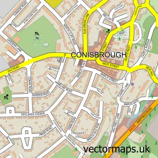
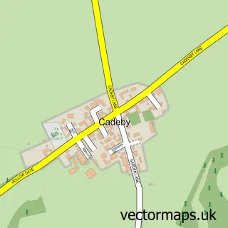
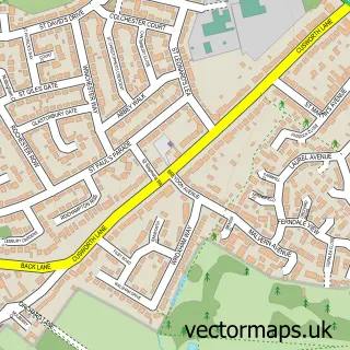
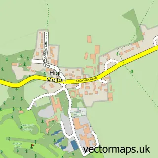
Nearby street map samples around Sprotbrough

More street maps in South Yorkshire
750 metre map area coverage
Boundary, postcode and point of interest information for the 750m x 750m rectangle centred on this sample map.
Boundaries containing map centre
Constituency: Doncaster North Co Const
District: Doncaster District (B)
Icb: NHS South Yorkshire ICB
Parish: Sprotbrough and Cusworth CP
Police Force: south yorkshire
Postcode District: DN5
Postcode Sector: DN5 7
Ward: Sprotbrough Ward
Nearby boundaries intersecting sample
Constituency: Rawmarsh and Conisbrough Co Const
Parish: Warmsworth CP
Postcode District: DN4
Postcode Sector: DN4 9
Ward: Edlington & Warmsworth Ward
Postcode coverage
POI category counts
Church Cathedral: 4
Beauty Salon: 3
Coffee Shop: 2
Indian Restaurant: 2
Pub: 2
Womens Clothing Store: 2
Anglican Church: 1
Bakery: 1
Bar: 1
Chimney Sweep: 1
Sample points of interest
- St Mary the Virgin
- The Custom Cakery
- The Cadeby Pub & Restaurant
- Blossom Beauty Room
- Elite Collective
- elemis
- Williamson's Chimney Sweep
- Daylight Singers
- SMC
- St Johns Church, Cadeby
- St Mary's Church
- St Marys Church Sprotbrough
Create a larger editable map of Sprotbrough
This sample shows only a 750 metre area. To create a larger map of Sprotbrough, use our map builder to choose your own coverage area, add titles and download editable SVG, PDF and PNG files.
Create a custom map of Sprotbrough