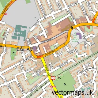
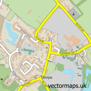
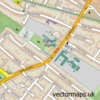
This Virginia Water street map is a detailed vector street map covering a 750m x 750m area. Select a larger area to create and download your own vector street map of Virginia Water.
The 750-metre map sample for Virginia Water covers 287 mapped buildings and approximately 11.1 km of road detail, of which 23 named roads are named. The immediate area includes 1 railway station, 1 GP surgery, with 2 within 2 miles and 6 MOT stations within 2 miles. The wider area around Virginia Water features 1 tourism point of interest and 4 food and drink venues. To create a larger or custom map of Virginia Water, the map builder lets you define your own coverage area and download editable SVG, PDF and PNG files.
Create a larger editable map of Virginia Water
Choose any area you need and generate a high-quality vector map instantly. Perfect for print, planning, design, business and personal use.

This Virginia Water street map in Surrey is available as downloadable SVG, PDF and PNG map files, or as a printed map for planning, business, display, education, local information and design work. You can also create a larger custom map area using the map selector.
What this Virginia Water map sample shows
Virginia Water lies within Surrey County parish, part of Virginia Water ward in the Runnymede District (B) local authority area. The postcode geography for this area includes the GU postcode area, the GU25 postcode district and the GU25 4 postcode sector. Residents fall under the Nhs Surrey Heartlands Integrated Care Board for NHS services.
Local features near Virginia Water
Within 2 milesAmenities and services in and around Virginia Water.
Administrative and postcode information for Virginia Water
The local authority covering Virginia Water is Runnymede District (B), within the county of Surrey. The settlement lies within Virginia Water ward and Surrey County civil parish. The GU25 postcode district and GU25 4 postcode sector serve the immediate area. NHS provision in the area is delivered through Ashford And St Peter's Hospitals Nhs Foundation Trust.
Nearby street map samples around Virginia Water

More street maps in Surrey
750 metre map area coverage
Boundary, postcode and point of interest information for the 750m x 750m rectangle centred on this sample map.
Boundaries containing map centre
Constituency: Windsor Co Const
County: Surrey County
District: Runnymede District (B)
Icb: NHS Surrey and Sussex ICB
Police Force: surrey
Postcode District: GU25
Postcode Sector: GU25 4
Ward: Virginia Water Ward
Nearby boundaries intersecting sample
No additional intersecting boundaries found.
Postcode coverage
POI category counts
Hair Salon: 5
Real Estate Agent: 5
Convenience Store: 4
Property Management: 4
Beauty Salon: 3
Doctor: 3
Indian Restaurant: 3
Barber: 2
Boutique: 2
Chinese Restaurant: 2
Sample points of interest
- Sarah Beckitt Hypnotherapy
- Signature at Virginia Water
- Augustus House - Retirement Living PLUS - McCarthy Stone
- Morrisons Daily - Virginia Water Station Pr
- Wentworth Patisserie
- Barclays Bank
- The Wine Circle
- Dan’s Turkish barber
- The Changing Man Barbers
- Attiya Beauty Studios Limited
- Essensuals Virginia Water
- Helius Professional Tanning & Beauty
Create a larger editable map of Virginia Water
This sample shows only a 750 metre area. To create a larger map of Virginia Water, use our map builder to choose your own coverage area, add titles and download editable SVG, PDF and PNG files.
Create a custom map of Virginia Water