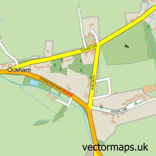
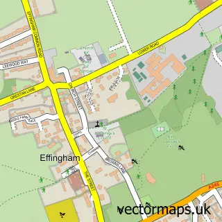
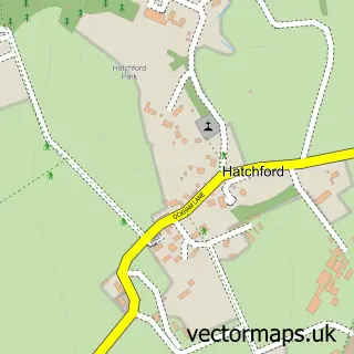
This West Horsley street map is a detailed vector street map covering a 750m x 750m area. Select a larger area to create and download your own vector street map of West Horsley.
The 750-metre map sample for West Horsley covers 232 mapped buildings and approximately 9.4 km of road detail, of which 12 named roads are named. The immediate area includes 1 school, 1 GP surgery within 2 miles, 2 pubs and 1 MOT station within 2 miles. The wider area around West Horsley features 2 food and drink venues and 1 campsite within 2 miles. To create a larger or custom map of West Horsley, the map builder lets you define your own coverage area and download editable SVG, PDF and PNG files.
Create a larger editable map of West Horsley
Choose any area you need and generate a high-quality vector map instantly. Perfect for print, planning, design, business and personal use.

This West Horsley street map in Surrey is available as downloadable SVG, PDF and PNG map files, or as a printed map for planning, business, display, education, local information and design work. You can also create a larger custom map area using the map selector.
What this West Horsley map sample shows
West Horsley lies within West Horsley Cp parish, part of Clandon And Horsley ward in the Guildford District (B) local authority area. The postcode geography for this area includes the KT postcode area, the KT24 postcode district and the KT24 6 postcode sector. Residents fall under the Nhs Surrey Heartlands Integrated Care Board for NHS services.
Local features near West Horsley
Within 2 milesAmenities and services in and around West Horsley.
Administrative and postcode information for West Horsley
West Horsley lies within West Horsley Cp parish, part of Clandon And Horsley ward in the Guildford District (B) local authority area. The postcode geography for this area includes the KT postcode area, the KT24 postcode district and the KT24 6 postcode sector. Residents fall under the Nhs Surrey Heartlands Integrated Care Board for NHS services.
Nearby street map samples around West Horsley

More street maps in Surrey
750 metre map area coverage
Boundary, postcode and point of interest information for the 750m x 750m rectangle centred on this sample map.
Boundaries containing map centre
Constituency: Guildford Co Const
County: Surrey County
District: Guildford District (B)
Icb: NHS Surrey and Sussex ICB
Parish: West Horsley CP
Police Force: surrey
Postcode District: KT24
Postcode Sector: KT24 6
Ward: Clandon & Horsley Ward
Nearby boundaries intersecting sample
No additional intersecting boundaries found.
Postcode coverage
POI category counts
Assisted Living Facility: 2
Dog Walkers: 2
It Service And Computer Repair: 2
Pub: 2
Art Gallery: 1
Automotive Repair: 1
Campus Building: 1
Caterer: 1
Community Center: 1
Cricket Ground: 1
Sample points of interest
- Adam Aaronson Glass
- Bupa Care Homes
- Dene Place Nursing Home
- Ct Cars Ltd
- Cranmore School
- Hilly's
- West Horsley Village Hall
- Horsley & Send Cricket Club
- Dance Arts104 Amanda Warwick
- West Horsley Dental practice
- Horsley Dog Walking & Pet Care
- Horsley Hounds
Create a larger editable map of West Horsley
This sample shows only a 750 metre area. To create a larger map of West Horsley, use our map builder to choose your own coverage area, add titles and download editable SVG, PDF and PNG files.
Create a custom map of West Horsley