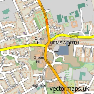
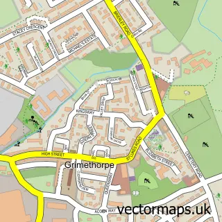
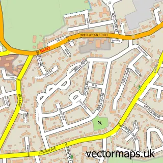
This Brierley street map is a detailed vector street map covering a 750m x 750m area. Select a larger area to create and download your own vector street map of Brierley.
The 750-metre map sample for Brierley covers 395 mapped buildings and approximately 11.4 km of road detail, of which 29 named roads are named. The immediate area includes 1 school, 5 GP surgeries within 2 miles and 10 MOT stations within 2 miles. To create a larger or custom map of Brierley, the map builder lets you define your own coverage area and download editable SVG, PDF and PNG files.
Create a larger editable map of Brierley
Choose any area you need and generate a high-quality vector map instantly. Perfect for print, planning, design, business and personal use.

This Brierley street map in South Yorkshire is available as downloadable SVG, PDF and PNG map files, or as a printed map for planning, business, display, education, local information and design work. You can also create a larger custom map area using the map selector.
What this Brierley map sample shows
Brierley lies within Barnsley District (B) parish, part of North East ward in the Barnsley District (B) local authority area. The postcode geography for this area includes the S postcode area, the S72 postcode district and the S72 9 postcode sector. Residents fall under the Nhs South Yorkshire Integrated Care Board for NHS services.
Local features near Brierley
Within 2 milesAmenities and services in and around Brierley.
Administrative and postcode information for Brierley
The local authority covering Brierley is Barnsley District (B), within the county of South Yorkshire. The settlement lies within North East ward and Barnsley District (B) civil parish. The S72 postcode district and S72 9 postcode sector serve the immediate area. NHS provision in the area is delivered through Barnsley Hospital Nhs Foundation Trust.
Nearby street map samples around Brierley

More street maps in South Yorkshire
750 metre map area coverage
Boundary, postcode and point of interest information for the 750m x 750m rectangle centred on this sample map.
Boundaries containing map centre
Constituency: Barnsley North Co Const
District: Barnsley District (B)
Icb: NHS South Yorkshire ICB
Police Force: south yorkshire
Postcode District: S72
Postcode Sector: S72 9
Ward: North East Ward
Nearby boundaries intersecting sample
No additional intersecting boundaries found.
Postcode coverage
POI category counts
Anglican Church: 2
Beauty Salon: 2
Fish And Chips Restaurant: 2
Retirement Home: 2
Shipping Center: 2
Acupuncture: 1
Assisted Living Facility: 1
Atms: 1
Beauty And Spa: 1
Bridal Shop: 1
Sample points of interest
- Acupuncture-4Health
- St Paul's Church Brierley
- St. Paul the Apostle, Brierley
- Bollingbroke House
- Brierley Off Licence (Mirren) (Protected), Brierley
- Uniquescalpuk
- Dazzle & Shine
- KB House Of Beauty
- Signature Dress
- Oven Supremo
- Brierley Methodist Church
- Signature Dress
Create a larger editable map of Brierley
This sample shows only a 750 metre area. To create a larger map of Brierley, use our map builder to choose your own coverage area, add titles and download editable SVG, PDF and PNG files.
Create a custom map of Brierley