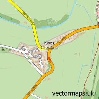
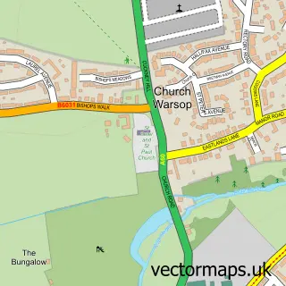
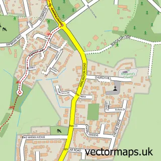
This Clipstone street map is a detailed vector street map covering a 750m x 750m area. Select a larger area to create and download your own vector street map of Clipstone.
The 750-metre map sample for Clipstone covers 495 mapped buildings and approximately 20.9 km of road detail, of which 21 named roads are named. The immediate area includes 1 GP surgery within 2 miles and 2 MOT stations within 2 miles. The wider area around Clipstone features 1 tourism point of interest and 2 food and drink venues. To create a larger or custom map of Clipstone, the map builder lets you define your own coverage area and download editable SVG, PDF and PNG files.
Create a larger editable map of Clipstone
Choose any area you need and generate a high-quality vector map instantly. Perfect for print, planning, design, business and personal use.

This Clipstone street map in Nottinghamshire is available as downloadable SVG, PDF and PNG map files, or as a printed map for planning, business, display, education, local information and design work. You can also create a larger custom map area using the map selector.
What this Clipstone map sample shows
Clipstone lies within Clipstone Cp parish, part of Edwinstowe & Clipstone ward in the Newark And Sherwood District local authority area. The postcode geography for this area includes the NG postcode area, the NG21 postcode district and the NG21 9 postcode sector. Residents fall under the Nhs Nottingham And Nottinghamshire Integrated Care Board for NHS services.
Local features near Clipstone
Within 2 milesAmenities and services in and around Clipstone.
Administrative and postcode information for Clipstone
The local authority covering Clipstone is Newark And Sherwood District, within the county of Nottinghamshire. The settlement lies within Edwinstowe & Clipstone ward and Clipstone Cp civil parish. The NG21 postcode district and NG21 9 postcode sector serve the immediate area. NHS provision in the area is delivered through Sherwood Forest Hospitals Nhs Foundation Trust.
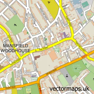
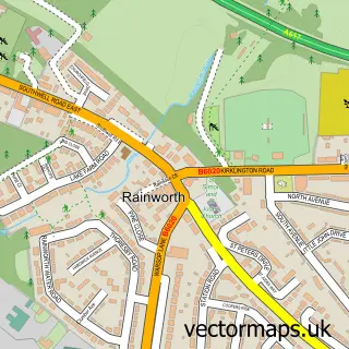
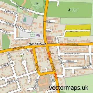
Nearby street map samples around Clipstone

More street maps in Nottinghamshire
750 metre map area coverage
Boundary, postcode and point of interest information for the 750m x 750m rectangle centred on this sample map.
Boundaries containing map centre
Constituency: Sherwood Forest Co Const
County: Nottinghamshire County
District: Newark and Sherwood District
Icb: NHS Nottingham and Nottinghamshire ICB
Parish: Clipstone CP
Police Force: nottinghamshire
Postcode District: NG21
Postcode Sector: NG21 9
Ward: Edwinstowe & Clipstone Ward
Nearby boundaries intersecting sample
Constituency: Mansfield Co Const
District: Mansfield District
Postcode District: NG19
Postcode Sector: NG19 0
Ward: Newlands Forest Town Ward
Postcode coverage
POI category counts
Automotive Repair: 4
Convenience Store: 4
Barber: 2
Beauty Salon: 2
Cafe: 2
Chinese Restaurant: 2
Elementary School: 2
Fish And Chips Restaurant: 2
It Service And Computer Repair: 2
Scout Hall: 2
Sample points of interest
- Vickers Water
- Rumbles Catering Project
- All Saints, Clipstone
- A M S Motor Repairs
- Cartune Garage Services
- ML Automotive
- Woody's Garage Services
- Jones Barber Shop
- Turkish barbers Clipstone
- Jones Barber
- Ink & Arch Aesthetics
- Xhibition
Create a larger editable map of Clipstone
This sample shows only a 750 metre area. To create a larger map of Clipstone, use our map builder to choose your own coverage area, add titles and download editable SVG, PDF and PNG files.
Create a custom map of Clipstone