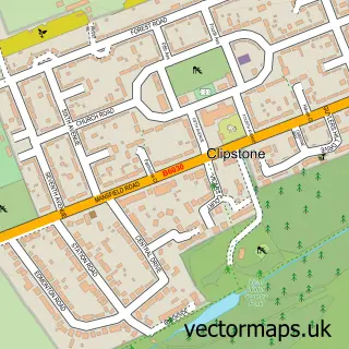
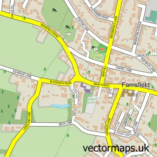
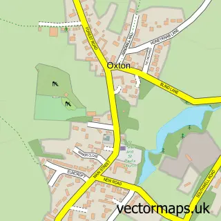
This Rainworth street map is a detailed vector street map covering a 750m x 750m area. Select a larger area to create and download your own vector street map of Rainworth.
The 750-metre map sample for Rainworth covers 403 mapped buildings and approximately 23.9 km of road detail, of which 23 named roads are named. The immediate area includes 1 school, 1 GP surgery, with 3 within 2 miles, 2 pubs and 11 MOT stations within 2 miles. The wider area around Rainworth features 4 food and drink venues and 1 hotel. To create a larger or custom map of Rainworth, the map builder lets you define your own coverage area and download editable SVG, PDF and PNG files.
Create a larger editable map of Rainworth
Choose any area you need and generate a high-quality vector map instantly. Perfect for print, planning, design, business and personal use.

This Rainworth street map in Nottinghamshire is available as downloadable SVG, PDF and PNG map files, or as a printed map for planning, business, display, education, local information and design work. You can also create a larger custom map area using the map selector.
What this Rainworth map sample shows
Rainworth lies within Rainworth Cp parish, part of Rainworth South & Blidworth ward in the Newark And Sherwood District local authority area. The postcode geography for this area includes the NG postcode area, the NG21 postcode district and the NG21 0 postcode sector. Residents fall under the Nhs Nottingham And Nottinghamshire Integrated Care Board for NHS services.
Local features near Rainworth
Within 2 milesAmenities and services in and around Rainworth.
Administrative and postcode information for Rainworth
Rainworth lies within Rainworth Cp parish, part of Rainworth South & Blidworth ward in the Newark And Sherwood District local authority area. The postcode geography for this area includes the NG postcode area, the NG21 postcode district and the NG21 0 postcode sector. Residents fall under the Nhs Nottingham And Nottinghamshire Integrated Care Board for NHS services.
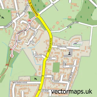
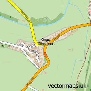
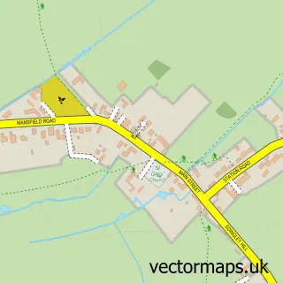
Nearby street map samples around Rainworth

More street maps in Nottinghamshire
750 metre map area coverage
Boundary, postcode and point of interest information for the 750m x 750m rectangle centred on this sample map.
Boundaries containing map centre
Constituency: Sherwood Forest Co Const
County: Nottinghamshire County
District: Newark and Sherwood District
Icb: NHS Nottingham and Nottinghamshire ICB
Parish: Rainworth CP
Police Force: nottinghamshire
Postcode District: NG21
Postcode Sector: NG21 0
Ward: Rainworth North & Rufford Ward
Nearby boundaries intersecting sample
Constituency: Mansfield Co Const
District: Mansfield District
Ward: Rainworth South & Blidworth Ward, Southwell Ward
Postcode coverage
POI category counts
Convenience Store: 6
Arts And Entertainment: 3
Church Cathedral: 3
Education: 3
Funeral Services And Cemeteries: 3
Home Service: 3
Automotive Repair: 2
Barber: 2
Beauty And Spa: 2
Building Supply Store: 2
Sample points of interest
- Glamatize Tribute Band
- Kirklington Road Welfare Ground
- Rainworth Mansfield
- Ocean City Mansfield
- Nisa Local (ERF), Rainworth Mansfield
- Rainworth Motorist Discount & DIY Store
- DPF Cleaning - DPF TECH
- Rainworth Garage Services
- Rainworth barber
- Razorcutz Barbers
- BE-U
- Beth Cresswell beauty therapy
Create a larger editable map of Rainworth
This sample shows only a 750 metre area. To create a larger map of Rainworth, use our map builder to choose your own coverage area, add titles and download editable SVG, PDF and PNG files.
Create a custom map of Rainworth