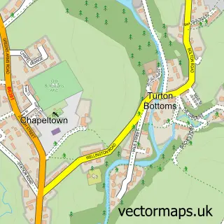
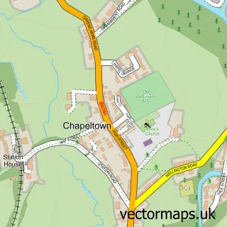
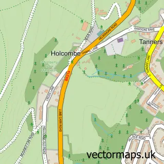
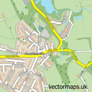
This Edgworth street map is a detailed vector street map covering a 750m x 750m area. Select a larger area to create and download your own vector street map of Edgworth.
The 750-metre map sample for Edgworth covers 331 mapped buildings and approximately 11.1 km of road detail, of which 23 named roads are named. The immediate area includes 2 pubs. The wider area around Edgworth features 1 tourism point of interest and 2 food and drink venues. To create a larger or custom map of Edgworth, the map builder lets you define your own coverage area and download editable SVG, PDF and PNG files.
Create a larger editable map of Edgworth
Choose any area you need and generate a high-quality vector map instantly. Perfect for print, planning, design, business and personal use.

This Edgworth street map in Lancashire is available as downloadable SVG, PDF and PNG map files, or as a printed map for planning, business, display, education, local information and design work. You can also create a larger custom map area using the map selector.
What this Edgworth map sample shows
Edgworth lies within North Turton Cp parish, part of West Pennine ward in the Blackburn With Darwen (B) local authority area. The postcode geography for this area includes the BL postcode area, the BL7 postcode district and the BL7 0 postcode sector. Residents fall under the Nhs Lancashire And South Cumbria Integrated Care Board for NHS services.
Local features near Edgworth
Within 2 milesAmenities and services in and around Edgworth.
Administrative and postcode information for Edgworth
The local authority covering Edgworth is Blackburn With Darwen (B), within the county of Lancashire. The settlement lies within West Pennine ward and North Turton Cp civil parish. The BL7 postcode district and BL7 0 postcode sector serve the immediate area. NHS provision in the area is delivered through East Lancashire Hospitals Nhs Trust.
Nearby street map samples around Edgworth


More street maps in Lancashire
750 metre map area coverage
Boundary, postcode and point of interest information for the 750m x 750m rectangle centred on this sample map.
Boundaries containing map centre
Constituency: Rossendale and Darwen Co Const
District: Blackburn with Darwen (B)
Icb: NHS Lancashire and South Cumbria ICB
Parish: North Turton CP
Police Force: lancashire
Postcode District: BL7
Postcode Sector: BL7 0
Ward: West Pennine Ward
Nearby boundaries intersecting sample
No additional intersecting boundaries found.
Postcode coverage
POI category counts
Professional Services: 3
Beauty And Spa: 2
Community Center: 2
Ice Cream Shop: 2
Pub: 2
Sports Club And League: 2
Active Life: 1
Auto Customization: 1
Bar: 1
Building Supply Store: 1
Sample points of interest
- Turton F.C.
- Hughes Speedshop
- Folk at the Barlow
- Calm Skin & Body Clinic
- YC Aesthetics
- Wolstenholme Services
- Prowess Resource
- Whiteheads Butchers & Edgworth Deli
- Barlow Institute
- The Barlow Edgworth
- Edgworth Cricket Club
- Post Office Travel Money
Create a larger editable map of Edgworth
This sample shows only a 750 metre area. To create a larger map of Edgworth, use our map builder to choose your own coverage area, add titles and download editable SVG, PDF and PNG files.
Create a custom map of Edgworth