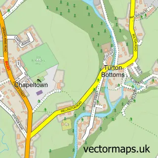
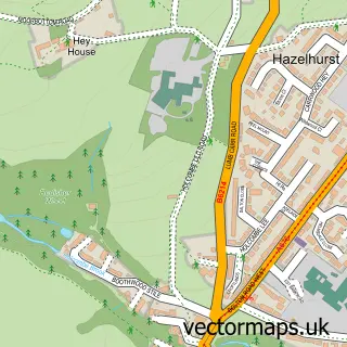
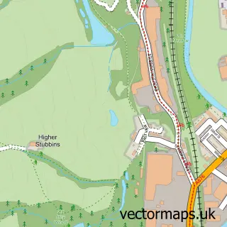
This Chapeltown street map is a detailed vector street map covering a 750m x 750m area. Select a larger area to create and download your own vector street map of Chapeltown.
The 750-metre map sample for Chapeltown covers 141 mapped buildings and approximately 7.6 km of road detail, of which 15 named roads are named. The immediate area includes 2 GP surgeries within 2 miles, 1 pub and 1 MOT station within 2 miles. The wider area around Chapeltown features 1 tourism point of interest and 1 food and drink venue. To create a larger or custom map of Chapeltown, the map builder lets you define your own coverage area and download editable SVG, PDF and PNG files.
Create a larger editable map of Chapeltown
Choose any area you need and generate a high-quality vector map instantly. Perfect for print, planning, design, business and personal use.

This Chapeltown street map in Lancashire is available as downloadable SVG, PDF and PNG map files, or as a printed map for planning, business, display, education, local information and design work. You can also create a larger custom map area using the map selector.
What this Chapeltown map sample shows
Chapeltown lies within North Turton Cp parish, part of West Pennine ward in the Blackburn With Darwen (B) local authority area. The postcode geography for this area includes the BL postcode area, the BL7 postcode district and the BL7 0 postcode sector. Residents fall under the Nhs Lancashire And South Cumbria Integrated Care Board for NHS services.
Local features near Chapeltown
Within 2 milesAmenities and services in and around Chapeltown.
Administrative and postcode information for Chapeltown
The local authority covering Chapeltown is Blackburn With Darwen (B), within the county of Lancashire. The settlement lies within West Pennine ward and North Turton Cp civil parish. The BL7 postcode district and BL7 0 postcode sector serve the immediate area. NHS provision in the area is delivered through East Lancashire Hospitals Nhs Trust.
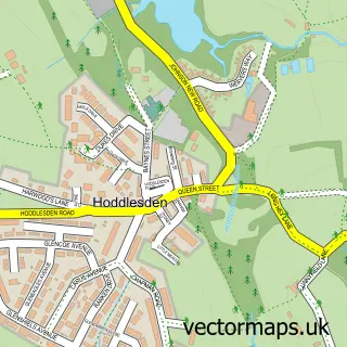
Nearby street map samples around Chapeltown


More street maps in Lancashire
750 metre map area coverage
Boundary, postcode and point of interest information for the 750m x 750m rectangle centred on this sample map.
Boundaries containing map centre
Constituency: Rossendale and Darwen Co Const
District: Blackburn with Darwen (B)
Icb: NHS Lancashire and South Cumbria ICB
Parish: North Turton CP
Police Force: lancashire
Postcode District: BL7
Postcode Sector: BL7 0
Ward: West Pennine Ward
Nearby boundaries intersecting sample
No additional intersecting boundaries found.
Postcode coverage
POI category counts
Building Supply Store: 2
Church Cathedral: 2
Alternative Medicine: 1
Amateur Sports Team: 1
Beauty Product Supplier: 1
Beauty Salon: 1
Day Care Preschool: 1
Electrician: 1
Financial Advising: 1
Irish Pub: 1
Sample points of interest
- Alternative Experience
- Old Boltonians AFC
- Calm
- Fabulous Skin by Hayley
- Mercer Brothers
- S J Garden Advice
- St Anne's Church
- St Anne's with St James'
- Jumbles Children's Nursery
- P D Circuits
- Christopher Bradbury
- Chetham Arms Turton
Create a larger editable map of Chapeltown
This sample shows only a 750 metre area. To create a larger map of Chapeltown, use our map builder to choose your own coverage area, add titles and download editable SVG, PDF and PNG files.
Create a custom map of Chapeltown