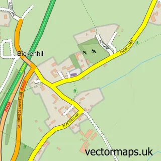
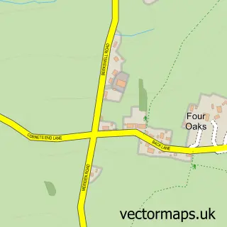
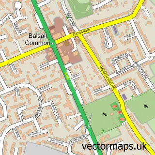
This Hampton-in-Arden street map is a detailed vector street map covering a 750m x 750m area. Select a larger area to create and download your own vector street map of Hampton-in-Arden.
The 750-metre map sample for Hampton-in-Arden covers 243 mapped buildings and approximately 26.8 km of road detail, of which 19 named roads are named. The immediate area includes 1 school, 1 railway station, 1 GP surgery and 2 pubs. The wider area around Hampton-in-Arden features 4 food and drink venues, 2 hotels and 1 campsite within 2 miles. To create a larger or custom map of Hampton-in-Arden, the map builder lets you define your own coverage area and download editable SVG, PDF and PNG files.
Create a larger editable map of Hampton-in-Arden
Choose any area you need and generate a high-quality vector map instantly. Perfect for print, planning, design, business and personal use.

This Hampton-in-Arden street map in West Midlands is available as downloadable SVG, PDF and PNG map files, or as a printed map for planning, business, display, education, local information and design work. You can also create a larger custom map area using the map selector.
What this Hampton-in-Arden map sample shows
Hampton-in-Arden lies within Hampton In Arden Cp parish, part of Bickenhill ward in the Solihull District (B) local authority area. The postcode geography for this area includes the B postcode area, the B92 postcode district and the B92 0 postcode sector. Residents fall under the Nhs Birmingham And Solihull Integrated Care Board for NHS services.
Local features near Hampton-in-Arden
Within 2 milesAmenities and services in and around Hampton-in-Arden.
Administrative and postcode information for Hampton-in-Arden
Hampton-in-Arden lies within Hampton In Arden Cp parish, part of Bickenhill ward in the Solihull District (B) local authority area. The postcode geography for this area includes the B postcode area, the B92 postcode district and the B92 0 postcode sector. Residents fall under the Nhs Birmingham And Solihull Integrated Care Board for NHS services.
Nearby street map samples around Hampton-in-Arden

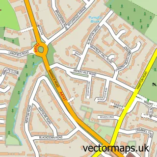
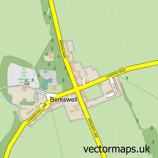
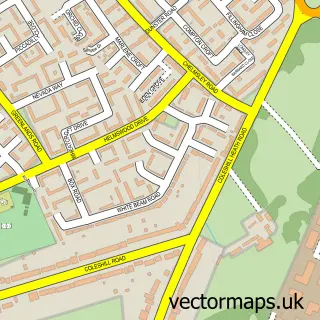
More street maps in West Midlands
750 metre map area coverage
Boundary, postcode and point of interest information for the 750m x 750m rectangle centred on this sample map.
Boundaries containing map centre
Constituency: Meriden and Solihull East Co Const
District: Solihull District (B)
Icb: NHS Birmingham and Solihull ICB
Parish: Hampton in Arden CP
Police Force: west midlands
Postcode District: B92
Postcode Sector: B92 0
Ward: Bickenhill Ward
Nearby boundaries intersecting sample
No additional intersecting boundaries found.
Postcode coverage
POI category counts
Church Cathedral: 3
Convenience Store: 3
Bakery: 2
Counseling And Mental Health: 2
Home Health Care: 2
Hotel: 2
Library: 2
Pub: 2
Restaurant: 2
Sports Club And League: 2
Sample points of interest
- Swoon Marketing
- SS Mary & Bartholomew
- The Fentham Hall
- ATM (Post Office)
- Vanderlande Industries United Kingdom
- Bakery at Hampton Manor
- The Old Bakery
- The Closet Boutique , Knowle
- The Cloth Bunting Company
- Dispatched Catering Supplies
- Top Chiropractic
- Hampton In Arden Church
Create a larger editable map of Hampton-in-Arden
This sample shows only a 750 metre area. To create a larger map of Hampton-in-Arden, use our map builder to choose your own coverage area, add titles and download editable SVG, PDF and PNG files.
Create a custom map of Hampton-in-Arden