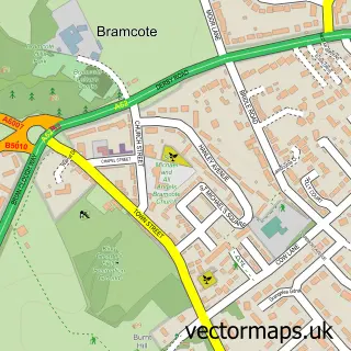
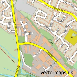
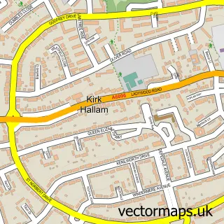
This Stapleford street map is a detailed vector street map covering a 750m x 750m area. Select a larger area to create and download your own vector street map of Stapleford.
The 750-metre map sample for Stapleford covers 598 mapped buildings and approximately 29.4 km of road detail, of which 51 named roads are named. The immediate area includes 1 school, 2 GP surgeries, with 9 within 2 miles, 5 pubs and 1 MOT station, with 21 within 2 miles. The wider area around Stapleford features 11 food and drink venues and 1 hotel. To create a larger or custom map of Stapleford, the map builder lets you define your own coverage area and download editable SVG, PDF and PNG files.
Create a larger editable map of Stapleford
Choose any area you need and generate a high-quality vector map instantly. Perfect for print, planning, design, business and personal use.

This Stapleford street map in Nottinghamshire is available as downloadable SVG, PDF and PNG map files, or as a printed map for planning, business, display, education, local information and design work. You can also create a larger custom map area using the map selector.
What this Stapleford map sample shows
Stapleford lies within Stapleford Cp parish, part of Stapleford South East ward in the Broxtowe District (B) local authority area. The postcode geography for this area includes the NG postcode area, the NG9 postcode district and the NG9 8 postcode sector. Residents fall under the Nhs Nottingham And Nottinghamshire Integrated Care Board for NHS services.
Local features near Stapleford
Within 2 milesAmenities and services in and around Stapleford.
Administrative and postcode information for Stapleford
The local authority covering Stapleford is Broxtowe District (B), within the county of Nottinghamshire. The settlement lies within Stapleford South East ward and Stapleford Cp civil parish. The NG9 postcode district and NG9 8 postcode sector serve the immediate area. NHS provision in the area is delivered through Nottingham University Hospitals Nhs Trust.
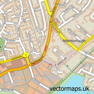
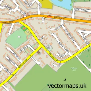
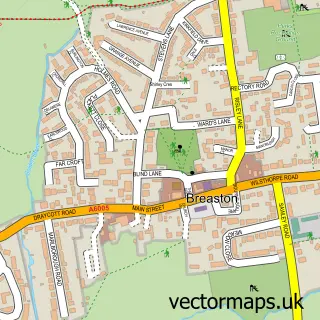
Nearby street map samples around Stapleford

More street maps in Nottinghamshire
750 metre map area coverage
Boundary, postcode and point of interest information for the 750m x 750m rectangle centred on this sample map.
Boundaries containing map centre
Constituency: Broxtowe Co Const
County: Nottinghamshire County
District: Broxtowe District (B)
Icb: NHS Nottingham and Nottinghamshire ICB
Parish: Stapleford CP
Police Force: nottinghamshire
Postcode District: NG9
Postcode Sector: NG9 7
Ward: Stapleford South East Ward
Nearby boundaries intersecting sample
Constituency: Erewash Co Const
County: Derbyshire County
District: Erewash District (B)
Parish: Sandiacre CP
Police Force: derbyshire
Postcode District: NG10
Postcode Sector: NG10 5, NG9 8
Ward: Sandiacre Ward, Stapleford North Ward, Stapleford South West Ward
Postcode coverage
POI category counts
Beauty And Spa: 7
Professional Services: 7
Bakery: 6
Pizza Restaurant: 6
Banks: 5
Charity Organization: 5
Pub: 5
Automotive Repair: 4
Beauty Salon: 4
Building Supply Store: 4
Sample points of interest
- TG Accountants LTD
- Lakeside Lawn Tennis Club
- Impact Marketing & Publicity
- St Helen's Church
- Nottingham Royal Society For the Blind
- Treetops Hospice Shop
- Decorating Warehouse
- Cinnamon Indian Restaurant
- MHA Nottingham
- Church Walk Garage
- Kwik Fit - Nottingham - Stapleford
- Paul Barton Tachographs
Create a larger editable map of Stapleford
This sample shows only a 750 metre area. To create a larger map of Stapleford, use our map builder to choose your own coverage area, add titles and download editable SVG, PDF and PNG files.
Create a custom map of Stapleford