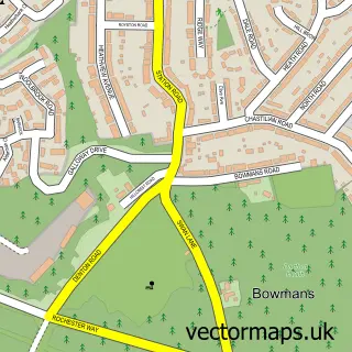
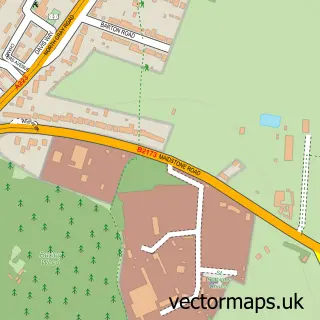
This Bexleyheath street map is a detailed vector street map covering a 750m x 750m area. Select a larger area to create and download your own vector street map of Bexleyheath.
The 750-metre map sample for Bexleyheath covers 498 mapped buildings and approximately 16.9 km of road detail, of which 28 named roads are named. The immediate area includes 1 GP surgery, with 13 within 2 miles, 4 pubs and 1 MOT station, with 37 within 2 miles. The wider area around Bexleyheath features 1 tourism point of interest and 8 food and drink venues. To create a larger or custom map of Bexleyheath, the map builder lets you define your own coverage area and download editable SVG, PDF and PNG files.
Create a larger editable map of Bexleyheath
Choose any area you need and generate a high-quality vector map instantly. Perfect for print, planning, design, business and personal use.

This Bexleyheath street map in Greater London is available as downloadable SVG, PDF and PNG map files, or as a printed map for planning, business, display, education, local information and design work. You can also create a larger custom map area using the map selector.
What this Bexleyheath map sample shows
Bexleyheath lies within Greater London Authority parish, part of Bexleyheath ward in the Bexley London Boro local authority area. The postcode geography for this area includes the DA postcode area, the DA6 postcode district and the DA6 7 postcode sector. Residents fall under the Nhs South East London Integrated Care Board for NHS services.
Local features near Bexleyheath
Within 2 milesAmenities and services in and around Bexleyheath.
Administrative and postcode information for Bexleyheath
The local authority covering Bexleyheath is Bexley London Boro, within the county of Greater London. The settlement lies within Bexleyheath ward and Greater London Authority civil parish. The DA6 postcode district and DA6 7 postcode sector serve the immediate area. NHS provision in the area is delivered through Lewisham And Greenwich Nhs Trust.
Nearby street map samples around Bexleyheath


More street maps in Greater London
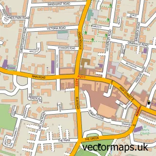
750 metre map area coverage
Boundary, postcode and point of interest information for the 750m x 750m rectangle centred on this sample map.
Boundaries containing map centre
Constituency: Bexleyheath and Crayford Boro Const
County: Greater London Authority
District: Bexley London Boro
Icb: NHS South East London ICB
Police Force: metropolitan
Postcode District: DA7
Postcode Sector: DA7 4
Ward: Bexleyheath Ward
Nearby boundaries intersecting sample
Postcode District: DA6
Postcode Sector: DA6 7, DA7 5, DA7 6
Postcode coverage
POI category counts
Beauty Salon: 4
Professional Services: 4
Pub: 4
Convenience Store: 3
Rental Kiosks: 3
Restaurant: 3
Assisted Living Facility: 2
Auto Electrical Repair: 2
Automotive Repair: 2
Barber: 2
Sample points of interest
- Avante Care and Support
- Parkview
- The Cooperative Food (BF) Long Lane (ERF)
- JWC Electrical Solutions
- Jc Electrical Solutions
- WJ King Vauxhall Bexleyheath
- Bexley Heath
- National Tyres and Autocare
- Maddison's Bakery
- CLASS Men's Grooming Room
- Long Lane Barbers
- Beauty Express Lounge
Create a larger editable map of Bexleyheath
This sample shows only a 750 metre area. To create a larger map of Bexleyheath, use our map builder to choose your own coverage area, add titles and download editable SVG, PDF and PNG files.
Create a custom map of Bexleyheath